"Part of the doctrine of geophysical science are the lame
explanations for the dealing with the recurring ice ages, periods of
history where the alleged advance and retreat of great glaciers from
the polar regions, advances and retreats which covered so much of
our globe and of which so much physical evidence remains.
"The more I delved into the actual physical evidence, the more
skeptical I became of the existing theories. There were many pieces
of physical evidence which, in certain respects appeared to be at
variance with the theories....
To make sure I hold your attention, let me say that unless instant
remedial action is taken, all of mankind and our civilization will
soon be destroyed."
"Oh Christ," thought the interviewer, "another goddamned Doomsday
nut!"
"You no doubt are thinking that I am insane, but I assure you that
such is not the case. I remind you that you agreed on being my
interviewer that you would hear out the entire basis of my theory
before reaching any conclusions.
Periodically, throughout the history of the earth - at
intervals
ranging from 3,000 to 7000 years but averaging around 5,500 years
apart - great global cataclysms occur which effectively destroy
virtually all of whatever life forms or civilizations have developed
on the earth to that point. The cataclysm occurs when the earth is
badly thrown off balance due to a massive accumulation of ice at the
polar regions. As this polar ice grows and creates and imbalance
with it’s enormous weight, a wobble begins to develop in the
rotation of the earth on it’s axes. Year by year, as the ice caps
grow, the eccentricity of rotation increases until finally a
critical point is reached. At that point the tilt of the earth
reaches a point where it no longer can overcome the centrifugal
force of the spinning earth. With devastating suddenness, the polar
masses are thrown toward the point of greatest spin, which is the
equator. Quite abruptly, the areas which were polar now have become
equatorial, and vice versa. The resultant cataclysm is, of course
monumental across the entire face of the earth except at the two
points which become pivotal when the capsizing effect occurs. In an
effort to paint a better verbal picture for the interviewer,
Boardman made and analogy.
Picture the earth he said, "as a round ball spinning in place on a
glass tabletop, it’s speed of spin very fast and constant. Imagine
then, that on the uppermost part of this spinning ball, you drop a
tiny glob of molten metal, just slightly off center. the ball
immediately begins to wobble... Add more metal, more weight and that
wobble becomes more pronounced. Add still more and the eccentricity
becomes so great the centrifugal force of the spinning ball grips
the weight and turns the entire ball so that the heavily weighted
portion is thrown to the outermost rim of the spin - the imaginary
line encircling the ball where the speed is greatest - which is
coincident with the imaginary line on earth known to us as the
equator. That is precisely what happens periodically to the earth.
The buildup of ice at the poles increases such proportions and
eccentricity that its weight is thrown some ninety degrees from pole
to equator."
As the earth is 26 miles greater in diameter when measured around
the equator, than when measured around the poles, on the scale of
the earth such a variance is far less than the manufacturing
tolerances of an ivory billiard ball.
As the process of solar warming of the oceans and the corresponding
evaporation of the oceans with the moisture thus released
precipitating again as rain or snow all over the earth, the snows
that fall on the polar caps do not melt or flow off at anything like
the rate at which they evaporate off of the land elsewhere on earth.
Snow at the poles impacts upon itself and gradually turns in to
glacial ice. As this process continues without pause, as a normal
physical course of events, the ice caps continually increase in
size. At a symposium of the Union of Geodesy and Geophysics,
Dr Pyyotor Shoumsky reported studies that prove conclusively that the
south polar ice cap was growing at a minimum rate of two hundred
ninety three cubic miles of ice annually. To put that number in
perspective, Lake Erie contains water totaling a hundred and nine
cubic miles. Thus, a blanket of ice forms on top of the existing ice
at Antarctica each year which is almost three times the volume of
water in Lake Erie. That is equal to a layer of ice a mile wide and
two miles high from New York to Chicago. And this is the buildup of
only one year! These figures were confirmed by Franz Loewe of France
and Malcolm Mellors of Australia. There is no mistake.
"The present ice mass is considerably over five and a half
million square miles. If the South pole were over Chicago, that
would make a two mile thick slab of ice extending from Hudson’s
Bay to Key West in Florida.
"Even this wouldn’t be a threat if it were perfectly centered over
the earth’s axis of spin, but it is not and that’s our villain. The
wobble was discovered by astronomers in 1885. It amounted to only a
fraction over and inch. By the mid 1930’s this had increased to just
over six feet. In 1970, the radial movement was close to eighty
yards. And right now (1978) the wobble is approaching a half-mile in
radius.
"There is no known means of calculating the point at which rollover
will occur. It could conceivably happen with another fraction of an
inch of added eccentricity. Then again, it might be able to add
another mile or more. Eventually, thought, it’ll reach that critical
point of no return and the capsizing effect will occur with
essentially nor warning. Overcoming the gyroscopic stabilizing
effect of the earth’s equatorial bulge and in obedience to the laws
of centrifugal force the weight of the ice will be thrown toward the
strongest area of spin, which is the equator. The earth continues
spinning on it’s axis as before, but now with some dramatic
differences: The ice caps are riding on the equatorial spin, there’s
a new axis, and practically all life - Man included has been
extinguished.
"This is not just a one-time occurrence, it happens over and over
again..... there have been thousands of such rollovers, perhaps even
millions during the four and a half billion year history of the
earth.
"The resultant cataclysm to the earth’s surface when such a
capsizing occurs must be a stupendous sight to behold. Take the
effect on the oceans alone. It’s as if you’re holding at arm’s
length in your hands a basin filled with water and then you suddenly
spin ninety degrees to the right. Think of the volcanic eruptions,
the rifts where the earth splits apart, the mountain chains thrust
upward in the areas where the surface compresses. Cyclonic winds and
thunderstorms! Mountainous tidal waves, earthquakes,
electrical
storms of inconceivable intensity, volcanic eruptions.... The awful
grandeur of it all! Mother nature on an all-out rampage!"
The interviewer asked for proofs and was promised that they would be
forthcoming but Mr Boardman was tired, so they agreed to resume
after a night’s rest. However before turning off the tape recorder,
the interviewer asked: "You mentioned before that we must act
quickly to forestall this disaster, how much time do you reason we
have?"
Boardman replies: "...the interval of time between each occurrence
ranges between three thousand and seven thousand years. The oldest
epoch of the past was just about seven thousand years give or take
fifty. The physical evidence indicates that our present epoch is in
approximately its seventy fifth century. As this suggest, we’ve been
living on borrowed time for quite a while."
Equatorial bulge Displacement.
As noted, the capsizing planet,
instigated by the migration of overweighed ice through centrifugal
force to the outermost rim of spin, slowly but very rapidly
accelerates in speed until it reaches 45 degrees from the Axis of
Spin, which is the source of the centrifugal force acting on the ice
mass.
Immediately upon passing this 45-degree point, an equally rapid
deceleration begins, and the ice cap comes to a full stop between 10
and 15 degrees of the former line of the equatorial latitude. The
reason for this is that the equatorial bulge--moving more slowly, to
be sure, to overcome the resistance of earth crust materials--has
been moving to meet the onrushing ice cap.
Thus, the capsizing of the ice cap is not a full 90 degrees, but
rather between 75 and 80 degrees. At the same time, the equatorial
bulge has moved 10 to 15 degrees toward the ice cap, with which it
merges. Immediately the two masses work in unison to establish the
new equatorial bulge for stabilization of the globe, still at right
angles to the Axis of Spin. But while this is occurring, the kinetic
energies of both icy mass and equatorial bulge have increased
billions of times what they were at the beginning of the capsizing,
Result and Aftermath.
During and following the capsizing of the
earth, incredible surface devastation occurs as earth elements
strive to adjust to the pressures and absorb the phenomenal kinetic
energy which the rollover has generated.
A general chaos manifests itself in many forms--torrential rains,
electrical storms unbelievable in their intensity, dust storms,
hurricanes, typhoons, massive and extensive earthquakes, a multitude
of volcanic eruptions and, most devastating of all, a monstrous
deluge as tidal waves of fantastic power sweep all oceans, pounding
continents to pieces, inundating whole mountain ranges, rushing to
submerge great land masses that have always seemed high and safe,
and at the same time exposing masses of land which were heretofore
seemingly at too great a depth ever to move above sea level.
Existing mountains will be raised or lowered in relation to sea
level, old ranges will be flattened and new ones appear.
There will not be the gradual withdrawal of ice, as theorized in the
prevailing "Toe Age" concept of alternately growing and receding ice
caps. The ice cap, now directly on the equator and fully exposed to
the blazing heat of the sun, will begin to melt at once and, while
it may have taken thousands of years to reach its present enormous
size, it may take only brief decades for the total thaw to occur.
As it disappears, the ice cap will leave behind telltale evidence
of its former presence. An enormous depression will remain in the
surface of the earth where it sat and this will be ringed by a vast
circular range of mountains or hills or elevated plateaus, rising
gradually from the center of the depression and then falling away
sharply on the outside of the rim--the residue of the earth
materials squeezed through isostasy from beneath the great weight of
the ice cap as it grew. Glacial striations will clearly show on many
of these rocks. Riverbeds will form and glacial runoff will carve
itself deeply into earth materials as the thaw occurs and vast
quantities of water form from the melting ice cap. At the same time,
the tropical areas which were suddenly shifted to the polar regions
undergo a quick-freezing process and soon are below layers of snow
gradually turning into glacial ice as new ice caps begin to form on
the earth even while the old ones are still melting.
As the great ice caps continue to melt, ocean levels will rise,
inundating still more areas of land and, as the isolated ice mass is
reduced and its weight is distributed as water throughout the
oceans, earthquakes of great strength and violence will continue to
occur as the equatorial bulge adjusts and readjusts to equalize and
stabilize the rearrangement of such a weight.
At last the violent disturbances buffeting the earth will settle
down and a new stability to the planet becomes evident. Earthquake
and volcanic activity virtually cease for perhaps hundreds of years
or longer. Little animal life remains on the land masses of the
globe but what is there, including human life, adjusts to the new
conditions and survives, evolving perhaps into entirely new life
forms as part of their continuing adjustment. Much marine life has
been wiped out, but much remains and it too must adjust and evolve
to survive in the new conditions, for the ocean temperatures have
been greatly lowered by the icy volumes of water rushing into the
sea from the glacial runoff. Adjustment in marine life will also
have to take place to compensate for the greatly reduced salinity of
the sea.
When at last the old ice caps have wholly disappeared and the ocean
levels are relatively stabilized, the slow but inexorable process
begins all over again. Over hundreds and thousands of years the
levels of the oceans will lower as evaporation sucks up the
moisture, carrying it to the new poles where it falls and compacts
and builds into new ice caps until finally those ice caps have
become so monumental in size that they begin to wobble eccentrically
and eventually capsize the earth once again in a continuing Cycle
visited upon the earth hundreds of thousands or perhaps even
millions of times during the four-and-a-half-billion-year history of
the planet....
The gradual lowering of that weight is comparable to the gradual
buildup of the glacial weight. As the pressure increases and the
weight sinks lower, it begins causing the mud to squeeze out from
under it. As the pressure becomes greater, more of the under
material gets Extruded and forms a raised rim around the perimeter
o? the weight. That, in essence, is what’s happening at Antarctica.
The weight of the ice cap is squeezing the material of the continent
out from under is. The extruded material forms a range of mountains
before it, all the way to the coastal areas and even beyond. There’s
good evidence that in this way not only is the ice cap growing, but
the continent itself is Expanding."
"The danger lies in what happens through the creation of this
perimeter of mountains. The new mountain range serves as a barrier
which prevents the flow-off of the glacial ice into the sea In
effect, a huge basin has been created, an actual impoundment of
sorts. This allows a much increased volume of ice to accumulate
inland and add its weight to the ice cap."
"This buildup has progressed through the centuries. About three
hundred years ago, one of the edges of the ice cap pushed beyond the
continental mass. This was probably because of two reasons: first,
because the mouths of continental rivers did not allow for as great
a barrier of mountains to be thrown up at the perimeter as
elsewhere; and then also because the depth of the ocean close to the
shore of the continental mass allowed some portions of the mountains
to literally be shoved off the continent and slid down to the bottom
of the sea It was at that time that the first icebergs began being
sloughed off by the ice cap into the water. This tends to act as
something of a safety valve, because it gets rid of some of the
weight that has accumulated." "But not enough?" Asked the
interviewer.
"Nowhere near enough, As a safety valve, it’s very imperfect. With a
regular flow of icebergs being shed into the ocean, there is still
more new ice accumulated in one month than is carried off by
icebergs in a year.
To go on, pretty much the same thing on a smaller scale is occurring
with the ice cap presently on Greenland. Just as with
Antarctica,
Greenland’s and mass has become a depressed rock basin with the
weight of the ice cap up-thrusting a range of coastal mountains
before it. Much of the rock floor of Greenland is now well below sea
level, because of this Extrusion of rock forming the ice basin. The
mass of the ice caps at both poles is Increasing every day and right
now the weight of the Antarctic ice cap is around three tons per
square inch."
"As a sidelight, this sheds a whole new view on why some present
areas of the earth are far below sea level--areas such as the Dead
Sea region in the Middle East, the Valdes Peninsula in
Argentina,
Death Valley in California, and so on. These areas, according to
the HAB Theory, were once polar seats and became deeply indented by the
weight of the ice caps which grew over them."
"I am convinced that modern man has it within his power to
simultaneously achieve his most spectacular triumph over the forces
of nature and equally save himself from extinction or severe
retrogression. For the first time in the history of the earth, man
possesses the ability to prevent the capsizing of the planet.
Through the use of thermonuclear devices strategically placed at
intervals along the twelve-thousand-mile coastal rim of the gigantic
Antarctic ice basin and then detonated simultaneously or in series,
great pressures can be alleviated.
Perhaps the scientists converging on New York for
the HAB Theory
Symposium will give some consideration to Tennessee’s famous fossil
footprints. Found during the last century near Brayton in
Bledsoe
County, these footprints are not in sandstone, such as those
recently described ... which were only 25 million years old. The
series of footprints of bare human feet near Brayton are embedded in
solid granite which is probably hundreds of millions of years old.
Not only that, the human who made those prints must have been
gigantic, for the heel alone measures 13 inches in width.
 Could it be, that previous civilizations of man were destroyed by
such capsizing of the entire planet? Could it be that this was what
caused the extinction of the mysterious race which originally built
the amazing cities the ruins of which are extensive in Peru long
before the ancient Incas were living their own highly advanced
civilization? Perhaps now one of the most puzzling of these, the
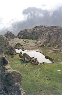
incredible find at Marcahuasi
(image right), only 80 kilometers northeast of this
city, can be solved.... unanswered questions regarding the pre-Incan
civilizations which built the great structures at Machu Picchu,
Cuzco, Ollantaytambo, and Sasayhuaman. Were these the remains of a
civilization made extinct by a previous capsizing of the earth? The
remains were a continuing enigma to archaeologists, and undoubtedly
one of the most bizarrely jarring was a spectacular discovery made
in 1952 at an altitude of over 13,000 feet in the Andes.
Could it be, that previous civilizations of man were destroyed by
such capsizing of the entire planet? Could it be that this was what
caused the extinction of the mysterious race which originally built
the amazing cities the ruins of which are extensive in Peru long
before the ancient Incas were living their own highly advanced
civilization? Perhaps now one of the most puzzling of these, the
incredible find at Marcahuasi
(image right), only 80 kilometers northeast of this
city, can be solved.... unanswered questions regarding the pre-Incan
civilizations which built the great structures at Machu Picchu,
Cuzco, Ollantaytambo, and Sasayhuaman. Were these the remains of a
civilization made extinct by a previous capsizing of the earth? The
remains were a continuing enigma to archaeologists, and undoubtedly
one of the most bizarrely jarring was a spectacular discovery made
in 1952 at an altitude of over 13,000 feet in the Andes.
The discovery, made in 1952 by Dr. Daniel Ruzo, is a great
amphitheater of rock in which are magnificent sculptures--but
sculptures which, according to all we know, are wholly
anachronistic. Here, for example, among carvings of familiar South
American animals and people, can also be seen unmistakable carvings
in white dioritic porphyry stone of camels and cows, lions and
elephants, and other animals which have never lived here, along with
finely carved heads, in the same material, of Semites, Caucasians,
and Negroes, all of whom came to this continent less than 500 years
ago. There is even a perfect rendering of the turtle’s long-extinct
ancestor the amphichelydia; yet in all recorded history, the
amphichelydia is known only from its fossilized remains. It lived
during the Upper Triassic Period and became extinct about 180
million years ago. Where, then, could the sculptor have gotten his
model? There is also a rendering of a horse, but horses became
extinct here 9,000 years ago and did not reappear until brought by
Spanish conquistadors in the sixteenth century.
Dr. Ruzo’s great discovery too long has been ignored. It is now time
for science to take a fresh look at the mysteries of the past which
titillate and haunt the imaginations of all knowledgeable Peruvians.
...Previous Poles.
Using the same process-of location used in
ascertaining the location of the North Pole ice cap-in Epoch Number B.P. I (One epoch before the present epoch), the ice cap for B.P. 2
is found to have been where there is an even larger and deeper
depression in the earth than the Sudan Basin--present
Hudson Bay.
While the B.P. 2 Hudson Bay ice cap was in existence, the land
masses of India, Borneo, Africa and
South America lay in tandem
along the equatorial bulge.
Identification of Hudson Bay as the location of the North Pole in B.P. 2 is ascertained from calculation showing that it is
approximately the same distance from Lake Chad in the Sudan Basin as
the latter is from the present North Pole, indicating again a
separation of about 80 degrees of latitude.
The ice cap for B.P. 3 is ascertained in the same manner and proves
to center itself at the Caspian Sea which is located in a great
depression similar to that formerly occupied by the ice caps for the
Sudan Basin and Hudson Bay. All three of these depressions,
containing the Caspian Sea, Lake Chad and Hudson Bay, are presently
the drainage focus for river systems covering very large areas of
territory; rivers which flow into the depressed basins formed by the
weight of ice caps which previously rested on these sites.
It becomes possible to trace depression after depression on the face
of the earth as the location of a former ice cap. Glacial striations
were even discovered on Permian rocks two centuries ago in the
Amazon Valley within an area of twenty degrees on both sides of the
equator. As a matter of fact, such glacial striations are found in
the rocks of the earth at random places all over the globe.
So-called Ice Ages can be traced back through their telltale
striations on rock faces not only as far back as the Paleozoic
Era’s-Lower Cambrian Epoch of some 600 million years ago, but some
are even recorded as Precambrian, though these records begin to dim
over such a period of time with continued capsizing of the earth
and disruption of its surface. Three such Precambrian ice cap sites
are located in Africa, three others in Asia and two in
Australia.
Five glaciated horizons of the Permian Period (230-280 million years
ago) are found in South America and an equal number of the most
recent Ice Ages are located in North America.
In the present geologic epoch, called the
Pleistocene (of the
Quaternary Period and Cenozoic Era), which, in essence, takes in the
last one mullion years, many hundreds of earth capsizing have
occurred, along with their cataclysmic results. Beyond the
Pleistocene there have been many more. A partial listing of some of
the more important and obvious ice cap sites during the Paleozoic,
Mesozoic and Cenozoic eras can include:
-
the Gobi
Desert
-
Lake
Victoria
-
Mar Chiquita
in Argentina
-
the Black
Sea
-
Death
Valley, California
-
the Amazon
Valley
-
Baikal Lake
in the USSR
-
Lake
Winnipeg
-
the Null
Arbor Plain in Australia’s southwest
-
Baffin Bay
-
the Baltic
Sea
-
the Congo
Basin
-
the
Mediterranean Sea
-
Great Bear
Lake, Canada
-
Great Salt
Lake, Utah
-
the Thar
Desert in northwest in India
-
Aral Sea,
Uzbek, USSR
-
the Painted
Desert- Lakes Michigan-Huron-Superior
-
the Angola
Basin off the coast of western Africa
-
the Bighorn
Basin, Wyoming
-
in northeastern Siberia in the vicinity of Tabor
-
the Takla Makan
Desert north of the Himalayas
-
the Canary
Basin off the northwestern African coast
-
Great Slave
Lake, Canada
-
the
Argentine Basin 930 miles southeast of Buenos Aires
-
the Wharton Basin, 900 miles south of Djakarta
In every location where records written by nature or man can be
studied, each of these sites shows radial striations which pinpoint
the seat of a former ice cap. In the matter of duration, geologic
evidence indicates that an individual ice cap may grow to maturity
in as short a span of time as 2,900 years, although the average
appears to be more in the vicinity of 5,750 years. Only rarely does
an individual epoch react 6,500 years, and no other epoch within at
least the last dozen has lasted as long as the present one....
....paged rapidly through the section detailing how the cataclysms
had caused the fossilization of soft-bodied animals, fruits,
vegetation, dinosaur tracks and eggs. He read again about the
finding of fossil trees, or at least portions of them, from depths
of 13,000 feet beneath the earth’s surface through core boring; the
discovery of 59 horizontal strata of fossilized trees separated by
massive strata of marine clay-rock of non fossil variety at the
Sydney Mines of Cape Breton, Nova Scotia; the fact that carbon-14
dating of the mammoth remains found in Siberia and North America
clearly indicated a time frame of 7,500 years ago. All this material
very strongly supported the contentions of the HAB Theory, and he
was no less impressed by it now than he had been the first time he
read it.
He swiftly reread the portion explaining how the epoch duration
for the present was determined by the creepage rate of waterfalls
through their gorges and then slowed and began reading more
thoroughly again as he came to a different section detailing other
forms of evidence supporting the HAB Theory.
Further evidence of earth
capsizing can be found in massive mineral
deposits which man is in the process of tapping.
Highly illustrative among these are the numerous salt beds which are
found in subterranean strata. There is only one way to rationally
account for their presence: that they were at one time the bottoms
of land depressions which filled with sea water during capsizing of
the earth, then became exposed again in subsequent capsizing as
salt wakes. Gradually, as the waters evaporated, the salts
precipitated to the bottom as residue.
Seven successive beds of these salt deposits have been found in
central New York, and a massive one is presently being tapped a
thousand feet below the city of Cleveland, Ohio. Over 30 such beds
have been discovered in the American Southwest, some deeply buried,
some just under the surface. The most significant on the North
American continent, however, is the one which is presently being
formed in a lake which, while constantly evaporating, still covers
an area about the size of the State of Delaware--the Great Salt Lake
of Utah. This 2,000-square-mile lake is the last trace of the great
prehistoric body of water known to geologists as Lake Bonneville,
which covered an area of 20,000 square modes and was over 1,000 feet
deep. The great Bonneville Salt flats are on the surface now, but
following the next capsizing of the earth they will probably become
silted over and eventually, following further capsizing of the
earth, become yet another of the multitude of subterranean salt
beds.
Coal is another mineral deposit clearly corroborating the theory of
successive capsizing of the earth. Coal beds are found in
subterranean deposit on a worldwide scale, including the Arctic and
Antarctic, and even beneath the ocean floors. Coal mines are
presently in operation in the Pacific off the coast of Chile and in
the Atlantic off Nova Scotia and England.
There is only one way that coal can be formed. It is the residue of
warm temperate, subtropical and tropical climate vegetation. Through
hundreds or thousands of years great quantities of vegetative
debris--leaves, twigs, fruits, branches, roots--sink to the bottoms
of swamps, rivers or lakes. The water covering them reasonably
protects them from the oxidation that would have occurred had they
been exposed to the air.
At the time of the capsizing of the earth, the submerged deposit of
vegetable debris is suddenly shifted to a region of subzero
temperature and immediately the water above it freezes. During the
polar summer there occurs enough of a thaw to allow siltage to
accumulate on the bottom over the mucky vegetation. When the next
capsizing of the planet occurs and the deposit is shifted back to a
tropical or temperate zone, the layer of silt prevents oxidation of
the vegetable matter below it from occurring, while at the same time
a new collection of vegetable matter is accumulating on top of the
silt. Through repeated capsizings and increasing pressures, the
vegetation layers are compressed into coal and the polar siltage
layers become slate or shale. Some of the coal mines in Pennsylvania
have shown as many as seven horizonal layers of coal with as many
corresponding layers of slate or shale interleaved between.
Recurrent capsizings of the earth can be the only reasonable and
logical explanation for such formations.
Another foundation stone in the
construction of support for the HAB
Theory postulations lies in the discovery in the relatively recent
past of magnetic rocks which vary from the direction of magnetic
electrical forces present being imbued into rocks of the earth. The
ancients knew of the existence of magnetic rocks, of course, and
used them as compasses in their navigation. These were simply rocks
magnetized to point north and south by the electrical currents of
the earth. But now, much older rocks have been discovered which,
though magnetic, do not point north and south but to differing
directions. This is powerful indication that they received their
magnetization at a time when the location of the poles differed from
what it is at present. Some of the rocks of this nature that have
been discovered point toward the Sudan Basin and others point toward
Hudson Bay. Still others point at other areas where physical
evidence indicates ice caps have formed in past epochs. Non
conventionally directional magnetic rocks have been discovered in 15
locations on the European and North American continents. They are
corollary to, and proof of, the recurrent capsizing of the earth...
...It is in the matter of the proofs where human history is
concerned that incredible new vistas of study are suddenly opened.
It is an acknowledged fact among ancient historians that authentic
and accurate history of man did not begin until between
approximately 7,000 and 7,500 years ago. Actual historical records
go back only as far as the earliest known civilizations, such as
those of Egypt, Peru, Babylonia,
India, Central America, Sumeria,
and Assyria. Yet, that 7,500-year period of time represents
considerably less than one percent of the time that man has been
known, through fossil remains, to have existed on earth.
A curious and yet exciting event of man’s history exists in the fact
that virtually at cultures in earth, from the most primitive to the
most civilized, have in the dim reaches of their history the record
or legend of a great flood.
-
In the Bible it is the story of
Noah.
-
In the Oriental book
The Ten Stems of China, are texts about it.
-
In Eros the 12 clay tablets inscribed in Sumerian cuneiform comes
the Epic of Gilgamesh, which recounts the journeying of
Enkidu, a
sort of counterpart of Noah.
-
In Greek mythology,
Deucation and his wife, Pyrrha, are the only
survivors of a great flood visited on the earth by the great god
Zeus.
-
The ancient Brahmans,
Chat deans, Hindus and Babylonians have their
own records or legends about similar great floods from which onto a
smart handful of individuals escaped with their lives.
-
Similar legends are found among the
Indians of the Americas and
among the aboriginal tribes of Australia, Borneo,
Sumatra, Africa,
and Southeast Asia.
Generally, we moderns have looked upon these stories as being
apocryphal, but perhaps we have been wrong. Perhaps much more truth
underlies them than we had previously suspected. And while the
support they provide cannot at this time be considered proof, they
do provide interesting and sometimes rather awesome corroboration to
the theory of a recurrently capsizing earth.
Apart from consideration of such legends or so-called records,
elements of stronger proof of the HAB Theory’s validity have become
available in man’s history through archeology.
In Iraq, for example, near the confluence of the
Tigris and
Euphrates rivers, is the site of the ancient Chaldean city of Ur.
Evidence exposed by archaeologists digging through layer after layer
to a depth of 50 feet proved that over 130 dynasties existed there.
Then, at just over 50 feet, they encountered a 0000000 foot-thick
layer of clay. Beneath that layer were discovered the remains of
another 10 dynasties, but of such difference that the artifacts
recovered from these lower layers bore little resemblance to those
discovered in the layers above. Pottery below the clay was
beautifully and skillfully painted, but that above the clay was not.
Copper artifacts were common in the dynasty layers above the clay,
but absent in those below. The archaeologists were unanimous about
only one aspect--that the layer of clay had to be the residue of a
great flood which buried the city under a dense blanket of silt. For
the silt to accumulate and turn into clay took a great while and,
though scientists are still not agreed to the exact amount of time
involved, the general consensus is that the upper layers were all
deposited within the last 6,000 years and perhaps as much as 1,500
years prior to that. The significance of the clay layer beginning to
form about 7,500 years ago is inescapable.
The ancient Greek
Solon, according to Plato, was told by Egyptian
priests in 600 B.C. that 9,000 years previously, Egypt had been
invaded by great armies from the powerful island empire of
Atlantis,
and that afterward Atlantis was devoured by the ocean in a great
deluge. The existence of such a place as Atlantis has long been held
as a myth, but in view of the accumulation of evidence, perhaps
there is more veracity to the story than heretofore believed. That,
however, is speculation on the writer’s part and not the province of
this summary....
Mr. Boardman outlined his plan for diminishing the
Antarctic ice cap
size in the following manner. The initial point at which man has to
attack the great glacier is along the entire perimeter of the
coastline, which Extends for 16,000 miles. The average rate of
slope, or gradient, from the center of the South Pole ice cap to the
sea is presently 7 feet per mile, as compared to a gradient of 28
feet per mile with the North Pole ice cap on Greenland. The gradient
of 7 feet per-mile at Antarctica is not sufficient to overcome the
barrier rim of mountains holding the ice in check. One of the most
urgent priorities Mr. Boardman mentioned was the need to accurately
ascertain the annual precipitation in snowfall on the existing ice
cap and the ratio of this accumulation to the annual evaporation,
ablation, and flow-off. In that manner, it could then be determined
exactly how much the flow-off would have to be increased to
stabilize the globe on its present Axis of figure, and then this
could be undertaken through the utilization of judiciously placed
and detonated thermonuclear devices as previously outlined in these
pages.
Mr. Boardman’s recommendations ended in the comment that we now have
before us a wholly new understanding of the limited time during
which our civilization has been developing and the deadly
precariousness of its continuance. We have before us, he contended,
only two alternatives: either we limit the present growth rate of
the Antarctic ice cap, or we accept a limitation to the time we have
remaining on this planet in civilization as we now know it.
This concludes the summarization of the theory of a recurrently
capsizing earth as postulated by Herbert Allen Boardman, summarizing
a quantity of text, mathematical formulae, sketches and photographs
equivalent to approximately 20,000 pages. This summary has been
prepared by order of the president of the united states for
consideration by the special scientific advisory committee appointed
by the president to study and evaluate the aforementioned
postulation known as the hab theory.
RESPECTFULLY SUBMITTED.
HAB Theory Commission
[A note on scientific discoveries that may not have been known to
Allan W. Eckert: There are places in Antarctica that are totally
arid, with no evidence of any precipitation at all in hundreds of
years. There are also great dry valleys in Antarctica, wide enough
for a small airplane to do a leisurely turn around within it’s
width, which show clear evidence of the passing of a glacier; the
smooth contours of the bowl, the scraping lines on the floor of the
valley, and boulders scattered in a neat but random pattern all
throughout the floor of the valley.]
Reykjavik, is quite a highly advanced civilization, with over a
hundred thousand people living in the city at present. There are
other far-northern cities similarly situated close to the Arctic
Circle. Fairbanks, Alaska, with a population of over Eighty
thousand. Nome, Alaska, Murrnansk are others.
"As a matter-of-fact,
Dr. Fleming," Irma Dowde continued, "Dr. Mathiessen is quite correct. There are at present major centers of
civilization at the fringe of the Arctic Circle, In his papers,
Mr.
Boardman suggests that the Egyptian culture, at the time the North
Pole was located in the Sudan Basin, was situated at almost exactly
the same distance from the pole of that epoch as Fairbanks, Alaska,
is today situated from the present North Pole. According to Mr.
Boardman, one of the two pivotal points was located in the area we
now know as Sumatra and the Malay Peninsula. The other was located
in the border area of Ecuador and Peru.
Do we have a botanist here?" Half a dozen or more hands went up at
once and Dr. Dowde pointed to a thin, sharp-faced woman of about
fifty sitting at the midpoint of the group, a couple of seats from
the center aisle. She stood immediately.
"I am Dr. Pamilia Parodi of Buenos Aires."
"Dr. Parodi do you have any background in the historical origin of
fruits and vegetables?"
"Yes," she replied with a small shrug. "It is one of the courses I
teach at the University of the Argentine."
"Excellent. Can you tell us, please, as briefly as possible, what
the origin is of some of our more important fruits and vegetables?"
"It will probably be of some interest," Dr. Parodi said, her voice
high and clear, "that the seats of origin of most of the world’s
important staple vegetables and fruits are the areas you’ve just
mentioned as being previous pivotal points--the Sumatra-Malaysia
area, and the Ecuador-Peru area. Most of our fruits have originated,
as best as can be determined, from a large radius of southern Asia,
of which the Malay Archipelago appears to be the hub, fruits such as
cherries, pears, apples, plums, olives, figs, grapes. Others, too,
perhaps--apricots and peaches, citrus fruits, bananas and coconuts
and mango. On the other hand, the basic vegetables seem to have
originated primarily in the upper Andes--Ecuador and Peru, as
mentioned, but also Bolivia and upper Chile. They would include both
white potatoes and sweet potatoes, yams, maize, numerous beans
including Lima and navy beans, pumpkins, squash, peppers, and many
others."
The botanist seemed to have finished, but just as
Dr. Dowde was
about to comment, she went on with a certain degree of hesitancy.
"It has never been clearly explained before, but perhaps now it may
be; there were cobs and kernels of popcorn found in ancient Peruvian
burial grounds which were thought to be unique to the world until,
some years later, identical species of popcorn were found in ancient
urns buried in the Naga Hills in the border country of
Burma and
Siam. Heretofore, this has been a very uncomfortable coincidence."
"Thank you, Doctor " said Irma Dowde, smiling. ’I think the
ramifications of what you’ve just said are quite clear. One further
question, though. Is there any botanical evidence existing which
links such fruits and vegetables to Egypt?"
The Argentine botanist shrugged elaborately. "I have heard of
none,
Dr. Dowde. The fruits and vegetables found there now came to that
land as they came to Europe and North America--through gradually
being transported there by migrating peoples."
As Dr. Parody reseated herself,
Dowde nodded and spoke to the group
in general. "Is it not possible, then," she said, "that an
Egypt
originally having a cold climate might account for the very notable
lack of early Egypt, as we know it, having virtually no such fruits
and vegetables? And, is it not strange that in one of the pivotal
areas, South America, we find another ancient civilization,
the
Inca’s, which, precisely like the Egyptian civilization, seems to
have drawn its early cultural and technological level from a source
it could never quite emulate, and which it was unable to maintain?
Both the cultures of Egypt and Peru seem to parallel one another in
being the slowly dying remnants of much greater civilizations of
which we have no knowledge whatever."
What I started to say,
Dr. Dowde, was wouldn’t it then be reasonable
to assume that the Eskimos of today were living in a tropical
climate before this present epoch, and that when the earth rolled
over they managed to survive and adapt to their new conditions?"
"Possibly," Irma Dowde conceded.
"And that when the pending capsizing does occur again-if it does,"
she added with a nervous little laugh, "that these same Eskimos
might become as prominent then as the Egyptians were at the
beginning of their history, as we know it?"
"According to the
Boardman postulations," the archeologist replied,
"when the next capsizing occurs the new poles will be located in the
Pacific in the vicinity of the Philippines and in eastern
Brazil. As
an anthropologist, Dr. Cantrell, your deductions along these lines
would undoubtedly be more pertinent than mine. The Eskimos are, of
course, relatively primitive in their present society, but there is
probably some justification for assuming that a portion of their
culture will remain and that perhaps even the more developed culture
of Fairbanks, Nome and other northern cities may persist to some
degree. All that is purely speculative at this point, but along
those lines I might ask here for the view of a paleontologist." A
florid-faced man of middle age sifting only a few seats away from
where Dr. Dowde was standing immediately came to his feet.
"I’m Hubert Sizer," he said crisply. "Colorado State University."
"Thank you, Dr. Sizer. You have read the HAB Theory summary, have
you not?"
"I have."
"In particular, have you read those portions dealing with the
mammoth remains found in Siberia and Alaska?"
"Yes. I was familiar with the discovery of them before reading the
summary, and with the inexplicable nature of such occurrences."
"You’ve also read the portion in the summary regarding the rising
and falling of continental masses, to form land hemispheres and
water hemispheres, depending upon how the capsizing of the globe is
triggered?"
"Yes."
"Could you mention other areas in the vicinity of
Siberia and Alaska
where mammoth remains of a similar nature have been found?"
"Well, yes, I suppose so. They’ve been found on Melville Island in
the Canadian Arctic, in Alaska and Siberia on both sides of the
Bering Strait, on the New Siberian Islands and on
Wrangel Island."
"Heretofore has there been any way of stating how these mammals of
identical species could have been found on land areas separated by
frigid seas?"
"Well," Dr. Sizer said, clearing his throat, "a land bridge across
the Bering Strait has always been a matter of conjecture. However,
there’s no real proof for it. Nor is there any explanation ’as to
how mammoths might have gotten to Wrangel or the
New Siberian
Islands.- Swimming in such seas would have been, for them, totally
out of the question, and it is doubtful that a Bering Strait land
bridge would have connected those islands to the mainland of
Siberia."
"Doesn’t it now seem likely, Dr. Sizer,"
Irma Dowde pressed on, "if
we assume the validity of the HAB Theory and take into consideration
the Boardman postulations of rising and falling land and water
hemispheres, that Asia and North America were almost assuredly part
of an unbroken land mass during B.P. 1, including the islands you’ve
mentioned, and that the mammoths--and probably the Eskimos or their
forebears--once roamed freely throughout this region in a tropical
or subtropical climate?"
Again Dr. Sizer cleared his throat. "Well now," he said, hedging his
words, "I wouldn’t want to be committed to this as a definite
pronouncement without considerable further study, but I suppose it
is a responsible possibility if one does in fact accept the HAB
Theory."
"And that the race of man in that region was able to adapt to the
change in climate and survive. But the mammoths and rhinoceroses
could not adapt and thus became extinct?"
"Well, again, yes,"
Sizer said, even more discomfited now, "but
still only on the basis of the HAB Theory’s being valid, and I’m not
at all sure I’m in accord with deeming it such’’.
"Excuse me,
Dr. Sizer. I had no intention of putting you on the
spot. I only wished for all of us to get a better general picture of
the interlocking nature of all these bits of information--data
which, if taken in an overall view, provide fascinating
possibilities, but which, if focused in one particular field, seem
to have no relationship to anything reasonably explainable within
that field."
"Dr. Dowde, I am David Ben Ribal, historian at Beirut University in
Lebanon. You mentioned earlier that the culture of the Egyptians
appeared full-blown, without any history antedating the First
Dynasty. Yet, if memory serves me correctly, it was about, the year
450 B.C. when the Greek historian Herodotus journeyed to both
Memphis and Thebes on the Nile and talked at length with the priests
there about their country and its history. At this time, again if
memory serves me correctly," he added, though Irma Dowde was sure
his memory was functioning quite well, "Herodotus was told by the
priests of Memphis that their records went back eleven thousand
years, and the priests of Thebes said their records covered the past
of seventeen thousand years. That seems very much to be in opposition
to the idea of a capsizing of the globe on the average of every six
thousand years. Even if they had survived such a cataclysm, wouldn’t
accounts of it have played important roles in what records we find
of them, and in what the priests themselves told to Herodotus?"
He sat down immediately, but before Irma Dowde could reply,
Balourdos spoke from the front of the room.
"I would like," he said, "if
Dr. Dowde has no objection, to comment
in that respect."
"None whatever, Dr. Balourdos," she responded, "but as soon as you
finish I will have to be leaving."
"Dr. ben Ribal," said the Greek archeologist, "you pose a most
interesting question. Perhaps not so surprisingly, the identical
question came to my own mind as I first read the summary in Athens.
We have of course," he added with some degree of pride, "a great
library at the University of Athens dealing with the lives and
activities of ancient Greeks. I delved into the matter to some
degree and discovered some rather startling facts.
"You are," he said, leaning his hip against the head table, "quite
correct in your recollection of the priests of Thebes and Memphis
relating to Herodotus that their historical records extended back,
respectively, seventeen thousand and 00000 thousand years.
Unfortunately, those records were on papyrus and skin scrolls,
housed in one of the greatest libraries of antiquity, the Alexandria
Library. Much of that library, along with a large portion of its
collection of seven hundred thousand scrolls--the equivalent of ten
thousand textbooks of today--was lost to fire during the reign of
Caesar. Nevertheless, the Alexandria Library was rebuilt and
continued to be a great font of knowledge and repository of ancient
records until A.D. 390. In that year the Bishop of Alexandria,
evidently insane and a religious fanatic, led a mob through the
streets of the city and pillaged the library of half a million of
its scrolls, all of which were burned in a street bonfire at the
order of the bishop. Not too long after that, the remainder of the
collection was destroyed by the invading army of Caliph Omer. So
much," he added sorrowfully, "for the written record of Egypt’s
past.
"Fortunately, though, during his visits to Memphis and
Thebes,
Herodotus noted some other very peculiar information passed on to
him by the priests. Information," he added meaningfully, "which
heretofore was greatly puzzling and largely discounted as
imaginings. Now, in light of this present theory, the histories
written by Herodotus take on a great and rather frightening
significance.
"Assuming," Balourdos continued, "that an observer in one of the
so-called safe areas of earth at the time of a capsizing were
looking at the heavens, he would note a drastic change in the course
of the moon, stars and sun. They would suddenly no longer be rising
and setting in the directions they had followed before. The sun
might strangely rise in the south instead of the east, and set in
the north instead of the west, because of the shift of the planet’s
surface in regard to its rotation. Or it might even shift a full one
hundred and eighty degrees, so that the sun would appear to rise in
the west instead of the east.
"For the sake of Example here," he went on, "imagine that at the
moment of the last capsizing of the earth it was nine in the morning
in Memphis. The earth began suddenly moving sideways even while
continuing the normal rotation from west to east. To an Egyptian
looking upward at such a time, it would appear that the sun had
stopped in its path, then moved about erratically for a while and
finally set very close to where it had risen.
"An impossible supposition?"
Michael Balourdos asked of no one in
particular, and then answered himself. "So it has always seemed.
Consider, though, what else it was the priests of Memphis related to
Herodotus. They told him with great assurance that in the history of
their country, spanning eleven thousand years--or, as they put it,
three hundred and forty one generations--Egypt had had three hundred
forty-one kings and a similar number of high priests, and that twice
during this span of time the sun had risen where it set, without any
great change in the productivity of their country. In a framework of
reference based on the HAB Theory, this heretofore inexplicable
statement begins having considerable relevance. Mr. Boardman
suggests in his postulations that the tendency is for the earth
to capsize back and forth in somewhat the same pattern time
after time, unless there is a change from a water hemisphere to
a land hemisphere. The possibility becomes clear, then, that
Egypt was fortunately situated where it could survive with little damage two
distinct land hemisphere capsizings of the earth.
"In other words," the big Greek archeologist concluded, "in B.P. 2
the earth was located approximately in the position it is now, but
with the North Pole at Hudson Bay instead of at its present site.
When the capsizing occurred, the planet rolled over, and the area
now known to us as the Sudan Basin became the site for the North
Pole. The Egyptians then lived in a climate not unlike that of
Fairbanks or Reykjavik.
"Another rollover occurred and once again the sun seemed to stand
still and then set where it had risen, and what had been the North
Pole became the Sudan Basis of today. The reference by Herodotus to
the sun rising and setting twice in the same direction in ancient
Egypt fits into the precepts of Mr. Boardman’s theory very nicely."
"I’d like to add one small point to the one you’ve just made,
Dr. Balourdos." Irma Dowde said, standing with her findings.
"Except for
just one thing, perhaps many more of us would accept it. That one
matter prevents me, and many others, from doing so. Unless it can be
resolved for us beyond any dispute, we will never accept it. I
should add that while this is my own very strong personal feeling, I
also say this as the official voice of the AGA.
"I have spent many hours on the matter I have just alluded to, and
now I wish to present it here for the record. The HAB Theory
contends that when a capsizing of the earth occurs, the ice caps are
suddenly located on the equator and areas which were previously
equatorial become sites for the new poles. This goes wholly against
long-established geological estimates which, for example, place the
age of the south polar ice cap at approximately thirteen million
years. All right, if we say for the sake of argument that our
geological time estimate is wrong then this brings up some very
disconcerting contradictions.
"Consider: after the alleged capsizing, the ice now on the equator
begins to thaw, but it is a process which takes scores of years to
complete. By the same process, the tropical areas now at the pole
freeze, very quickly on the surface but much more slowly to any
great depth. Largely, this is due not only to the great amount of
heat stored within the earth strata, and the insulating factor
involved in such stratification, but equally to the warmth of
surrounding oceans. True, with the thawing of the ice caps, the
temperature of the oceans gradually lowers, but it takes a great
while. We estimate that while snows would very quickly blanket the
ground surface of the continent that was now at the pole, it would
take about three hundred years before a true polar ice cap would
even begin to form. In the case of the continent of Antarctica,
which has an area of some five million square miles and a mean
diameter of twenty eight hundred miles, the ice cap would have begun
forming first at the location of the true pole itself which, in
Antarctica, is slightly off from being centrally located. For the
glacier to grow first upward and then gradually outward enough to
completely cover the continent, so that no actual land of the
continent was visible, would take from as little as forty-five
hundred years to as much as six thousand years."
"Now,
the HAB Theory sets the last capsizing of the earth of about
seventy-five hundred years ago. That would take it, on our present
Gregorian calendar, back roughly to the year 5500 B.C. This would
mean that until at least the year 1000...
’the Incas!"
Sanders said immediately.
"Not directly, sir," she replied. "Rather,
pre-Incan. But this is
not the principal point I’m making. Back in 1965 an Argentine
citizen, Juan Moricz, who is an amateur archeologist, was poking
about in the Ecuadorian Andes about a hundred fifty miles south of
Quito, in the Province of Santiago. He stumbled across another of
the most significant archeological finds of the past century--of any
century, for that matter," she amended. "He found a cave held in
superstitious awe by the Indian tribes of the area. After finally
gaining their confidence, he was allowed to enter the cave to
explore. What he found is just about as amazing as the Chinese
discovery and closely allied to it.
"The naturally formed cave gave way to a
smooth shaft, obviously
artificially made, which went straight down in three distinct drops,
each of two hundred and fifty feet. At the level of two hundred
fifty feet below the surface was a platform leading into a vault of
considerable dimension; radiating outward from this vault was a
whole series of artificial tunnels. The same situation was found at
the five-hundred foot level and at the bottom, seven hundred fifty
feet below ground level. The important aspects is that these tunnels
evidently were made in exactly the same manner as the tunnels in the Bayan Kara Ula Mountains in
China. Perfectly squared and highly
glazed, as if formed by means of intense heat. There are, Mr.
President, thousands--perhaps even tens of thousands--of miles of
these tunnels beneath Ecuador and Peru. Mostly they’re still
unexplored because the radiation in them very high and compasses
refuse to operate down there. Only a few hundred miles of them have
been Explored and those mostly in a cursory manner. There are a
great many chambers filled with artifacts and statuary but, most
important, there is one chamber in particular of immense
consequence."
The scientist licked her lips. Her throat felt dry and she wished
she had brought a glass of water in from the bathroom and put it on
the nightstand before she began this call. She swallowed and went
on.
"That chamber, with the unusual, highly glazed walls, ceiling and
floors, measures four hundred fifty-nine feet by four hundred
ninety-two feet. In the center of this room is a huge table around
which are seven chairs. They are fashioned of an unknown material,
as heavy as stone but not of stone. Nor are they metallic or wooden.
The closest approximation seems to be some sort of Extremely dense
plastic material, but far heavier than any plastic known. Forming a
perimeter around the table and chairs is a ring of sculptured
animals. Well, no," she corrected herself, "that’s not quite right.
They’re made of the same material and appear to have been molded."
"What kind of animals, Dr. Dowde?"
"Some which represent animals indigenous to the area, others which
definitely are not and never have been. There are jaguars and
cougars, but also there are lions, elephants,
wolves and bison.
There are also monkeys, gorillas, and bears, as well as small
invertebrates such as crustaceans and gastropods. All this--the
furnishings and statuary--are intriguing, but they fade in
significance to what else is in this room, some fifty feet from the
table. You are undoubtedly aware, sir, that archaeologists were for
many years agreed in the belief that the Incan and
pre-Incan
civilizations existed without any form of writing except a peculiar
sort of record keeping through the tying of knots in lengths of
cord. Yet, fifty feet from that center grouping is
an incredible
library permanently preserved in metal leaves. Each sheet of metal
is one point six millimeters thick--about a sixteenth of an inch--
but thirty-eight inches by nineteen inches wide. Yet, they’re so
sturdy that standing on the narrow edge and extending upward over
three feet, they remain perfectly rigid, with no sign of bending.
The metal most closely resembles zinc, but it definitely is not
zinc. Neither is it tin nor any other known metal or alloy.
"These metal pages stand side by side, held in place by great block
like pieces of material of the same substance the furniture is
fashioned from. And, Mr. President, each of these thousands of
leaves has stamped on it in regular order, just as if stamped by a
powerful press, line after line of a peculiar boxed form of writing.
The characters are wholly unfamiliar and seemingly of a
sophisticated hieroglyphic nature, but whatever culture produced
this amazing library also left with it the key to its deciphering.
In a special niche, obviously made precisely for the purpose it is
serving in one of the huge block bookends, is what appears to be an
alphabet of fifty-six characters stamped in a gridwork of squares on
metal of the same type as the leaves, but much thicker. A sort of
steel."
"The metal steel is an inch and a half thick,
five and a half inches wide and twenty and a half inches long.
From top to bottom there are fourteen rows of hieroglyphic
characters, with four characters per
row, confined within boxes which are exactly three and a half
centimeters square--that’s roughly an inch and three-eighths. None
of the characters are the same, but these very characters are used
in different combinations in the rows of characters on the metal
leaves."
"Comparable, then," the President put in, "to someone today placing
at the front of a large book a listing of the alphabet?"
"Precisely."
Irma Dowde issued a sour grunt. "Other than
Juan Moricz’s early--and
successful--efforts in this respect, no attempt has ever been made
to decipher them, although for a trained cryptologist it would
probably be a relatively simple matter. The metal steel of boxed
characters is far more important to the deciphering of those
hieroglyphics than was the Rosetta Stone in the deciphering of
Egyptian hieroglyphics."
"Then why,"
Sanders demanded, bewildered, "has no attempt been made
other than the early ones you mentioned?"
"Only the Ecuadorian government,
in its infinite wisdom, knows the
answer to that," she replied sardonically. "For the first four years
after his discovery, Juan Moricz maintained secrecy about it, but he
gradually realized the fantastic significance of his find and knew
it should be placed in the care of reputable scientific teams for
dose study. One of the big stumbling blocks was that he was not an
Ecuadorian. Nevertheless, in June of 1969 he petitioned the
government of Ecuador to give him legal title to the entire system
of tunnels and their contents, with the stipulation , in accordance
with article six hundred sixty-six of the ecuadorian civil code,
that though the treasures discovered became his personal property,
they also remained subject to state control. After the governmental
red-tape was cleared, and at last Moricz was granted the legal deed
for his find, everything seemed fine. Then, somehow word got out
that a great many of the archeological treasures in the upper level
passages were of solid gold or platinum. A governmental seal was
placed on the entrance and has remained there ever since. It is now
perpetually guarded with supposedly entry permitted to no one. What
purpose this accomplishes is anyone’s guess. Moricz has speculated
publicly that at intervals certain high government figures are
entering the tunnels and gradually disposing of great quantities of
the gold and platinum.
"Is anything of what he deciphered available?"
"Moricz spend a great deal of time first learning how to decipher
the hieroglyphics and then gradually translating the printed metal
leaves. He admits that he did not decipher them in sequence, but
rather a leaf here and there taken at random for the entire
collection... nothing has been published of the findings although a
few excerpts from his petitions to the government of Ecuador may be
enlightening:"
"’the objects I found are of the following kinds:
1. Stone and
metal objects of different sizes and colors
2. Metal plaques engraved with signs and writing. They form a
veritable metal library which might contain an synopsis of the
history of humanity, as well as an account of the origin of mankind
on earth and information about a vanished civilization
He began by saying that such definite records were indeed in
existence and had been found many years before. In China. He then
went on to describe the discovery and subsequent study of a large
number of peculiar stone disks that had been found in some
underground repositories in the Himalayas near the border of
Tibet.
The discovery of the
stone disks was made in 1938 by
Professor Chi Pu Tei an archeologist who was leading a body of his students on an
Expedition into the Bayan Kara Ula Mountains in the then-disputed
frontier territory of Tibet and China. The precise location was not
given he said it was in the general area of where Chang Thang
Province of Tibet and Tsinghai Province of
China abutted.
"That area, has been what is termed ’Positively Forbidden Territory’
for the Western world since the year 1938, which now, in light of
what Dr. Chow had to say, was probably not at all coincidental. At
any rate, Professor Chi Pu Tei and his students discovered what was
first described as a series of caves or caverns, but later admitted
to be a complex system of artificial tunnels and underground
storerooms. These tunnels are perfectly squared and the walls,
ceilings, and floors are highly glazed, as if somehow the passages
and rooms were carved by a device emitting heat of such intensity
that it simply melted its way into the mountains."
"As might occur," the President put in, "if you pushed a red-hot
nail into a block of wax?"
"A good comparison, Mr. President. Yes, Probably very similar to
that at least in appearance. All right, to go on, the archeological
group followed some of these passages and encountered larger
chambers in which numerous un-described implements were discovered.
The implements evidently differed from one chamber to another, but
one item was found in common in each of the chambers-- the stone
disks I mentioned earlier. Apparently in each of the chambers they
were found in the same position--on a smooth cube of rock, glazed
just as the tunnels were, with anywhere from seven to twenty of the
disks neatly stacked on top."
"I take it," Sanders said as the scientist paused, "that there is
something especially significant about these disks?"
"Very much so,
President Sanders. Each of them was twenty-two point
seven centimeters in diameter by two centimeters in thickness, which
is about three-quarters of an inch thick by nine inches in diameter.
Each disk also had a perfectly circular two-centimeter hole in the
exact center. The edges of the disks were regularly indented all the
way around, almost like a cogwheel, though neither sharply defined
nor amorphous. Somewhere in between the two, almost like the fluting
on a pie crust. however, we’ve yet to come to the most peculiar
characteristic of the disks. Each had a twin groove which began at
the center hole and gradually moved in an Expanding spiral
counterclockwise manner to the outer rim. The individual disks bore
a certain similarity to the phonograph records of today. There were
evidently slight differences from disk to disk in the actual
grooving, but the basic similarity was standard."
"What about the other items--the implements?"
"Dr. Chow did not comment to any length on what the other items were
that were stored in the chambers or what has happened to them, but
he did say that all of the stone disks were removed and taken for
study to the Peking Academy of Prehistory."
"How many were there?"
"A total of seven hundred sixteen of them."
"Go on."
"Nothing was heard about this discovery,"
Irma Dowde said, after
changing ears again, "by Western world scientists for the next
twenty-seven years. During that period, Dr. Chow says, the disks
were being studied intensively in a project headed by Professor Tsum
Um Nui at the Peking Academy."
"Question," the President said. "Before we get too far away from the
area where these disks were originally discovered, did Dr. Chow say
anything about that particular region--who inhabits it? What it’s
like?"
"As a matter of fact he did, Mr. President, in passing. But it does
bring out another curious element which has a distinct tie-in later
on. The Bayan Kara Ula Mountains area is one of the most isolated
and least known areas on earth today. The nearest city of any
consequence is Lhasa, Tibet about four hundred miles to the south
through virtually impassable terrain. It is an area presently
inhabited by two tribes of very unusual people."
"Unusual in what respect?
She sighed. "They simply do not fit into any racial category
established by anthropologists for the races of the world. For one
thing, they are both of pygmy stature. The tallest and shortest
adults have measured at four feet seven inches and three feet six
inches respectively, but the average height is four feet two inches.
They are yellow-skinned. Their heads are disproportionately large
and sparsely haired, and their eyes are large but not Oriental in
aspect, with pale bluish irises. Their features are very nicely
formed, most nearly approximating Caucasian, and their bodies are
extremely thin and delicate. Adult weight is estimated by Dr. Chow
to average, in our system of weights, about thirty-eight to
fifty-two pounds. The tribes call themselves
Dropa and Han.
"Unusual. Very unusual," Sanders muttered. please continue."
"The disks, as I was saying, underwent extensive study by
Professor Tsum Um Nui, interrupted at times by war. It took him and his
coworkers only a short time to discover that the spiral grooves were
not sound tracks but, rather, an incredibly ancient writing
inscribed in some unknown way and very nearly microscopic in size.
The disks were determined to be no less than three or four thousand
years old at the youngest, and more likely anywhere from eight to
twelve thousand years old. This would make them the oldest known
form of writing in the world. Deciphering was incredibly difficult.
It was twenty-four years--in 1962--before Professor Nui and a young
colleague found the key and began laboriously deciphering. That
young colleague happened to be our present group chairman, Dr.
Ho-Chung Chow. The deciphered spiral text of the stones, even though
only a small amount was completed, was so startling in its content
that the Chinese government prohibited any publication of the papers
of Nui and Chow. Then, in 1965, in a manner which Chow describes
with a peculiar smile was ’very mysterious,’ an article written by
the Russian philologist Vyacheslav Saizev appeared in Das
Vegetarische Universum, a German magazine, and in the
Russian-English magazine Sputnik, telling about the disks, their
qualities and composition, and a little about what had been
deciphered from them. It’s rather startling."
"Dr. Chow accidentally bumped one of the disks against a metal
table, and though it didn’t damage the disk, through his hand he
could feel a strange vibration. He then suspended one of the disks
with a strong line and tapped it with a metal rod. For nearly half a
minute the disk rang with a clear, perfect tone, much in the manner
of a tuning fork. Subjected to close analysis, the disk was found to
have a very high cobalt content, which in itself is incredible in
stones of such age. Further, there was a high metallic content to
them. All indications are that these disks were at some time part of
some sort of advanced and sophisticated electrical system. The
articles in both Sputnik and Das Vegetarische Universum presented
very little of the deciphered text, but what was there was
significant in light of the HAB Theory.
"’This is our story as
the Dropa have given us this means of
preserving our words forever on one of their many ’ecal.’ I don’t
know that word ’ecal’ at all," she said, "but it evidently refers to
these peculiar disks. Continuing. ’The Dropa stopped their great sky
ship in the air above us and terrified all our people. At first our
men and women and children hid themselves in caves, but then wonder
overcame fear and they emerged. Ten times during the night smaller
ships came out of the larger ship and floated to the ground among
us, and ten times we fled into the caves before sunlight. But then
the Dropa entered our heads with calming sounds and they made signs
of friendship, and they told us inside our heads that we should not
fear them, for their intentions were of a peaceful nature. As they
worked with their great machines and cut into the mountains they told
us of the great disruption and flood that was to come again as it
had come so many times before and that there was little time
remaining to preserve mankind, but we did not understand. In all our
history there had been only one flood and that was the great flood
which was ending as our lives here were beginning. The Dropa told us
not to fear because this was a safe place. Then, all but fifty of
the Dropa returned to the big ship and disappeared into it and then
the big ship moved quickly from our sight to return to the other
safe place’"
"That," Irma Dowde said, " is all, up until that time that had been
deciphered from one disk. It represents only about one- twentieth of
one percent of the grooving on that particular disk. Since Then, Dr.
Chow told us the efforts at deciphering have gone on. The entire
first disk has been translate into a volume of nearly two thousand
pages... but he would not tell what else was said there. The other
seven hundred fifteen disks have similar but more extensive double
grooving however its more difficult to decipher. No real progress
was made over the years since then until a significant key was
discovered just ten years ago. Five complete disks and a portion of
another four have been deciphered. He declined to comment at all in
respect to what they revealed except that one of the disks began by
the Dropa people commenting on their regret that the
larger sky ship
had been badly damaged in the turning of the earth - his exact
phraseology. The most modern mineral dating techniques have now
shown the oldest of the disks to be approximately eleven thousand
five hundred years old, and the others spaced in between that to the
latest which is approximately seventy five hundred years old. The
oldest disk is the one which comments on the damage to the ship by
the turning of the earth. The newest is the one, evidently recorded
by the progenitors of the Han tribe, telling of the visit by the Dropa and their warning of destruction.
"The corollaries to be drawn here,
Mr. President, are momentous.
If," she added with emphasis, "the ancient writings are to be
believed. And if, the entire discovery and deciphering is to be
believed. Taken in reference to Mr. Boardman’s postulations, they
fit much too well to be mere coincidence. According to Boardman, our
present epoch is somewhere around seventy-five hundred years old,
which ties in perfectly with the capsizing of the earth which he
claims to have occurred about that time, and which the Dropa were
obviously aware was approaching. Again, according to Boardman, the
epoch before our present epoch--that is, B.P. 1 lasted only about
four thousand years, which again ties neatly to the
eleven-thousand-five-hundred-year dating of the oldest disk and the
capsizing of the earth to end epoch B.P. 2 and begin epoch B.P.
1--further linked by the Dropas’ referring to the damage their large
ship had suffered in the turning of the earth.
There was an
extended silence on both ends of the line as Irma Dowde
finished, and then at last the President spoke, a sense of wonder
tinged with disbelief in his voice. "You chose your word well when
you said it was startling, Dr. Dowde. It’s an awful lot to chew. It
also opens one hell of a keg of worms. My immediate reaction is to
be extremely skeptical of any ancient race on earth having had the
ability to fly."
"I think we’ve all felt that way, sir, but we’re coming up with an
enormous number of references to the ancients having had the power
of flight. This is especially true, sir, with the Chinese. There are
numerous accounts of the Chinese having built flying machines only
to have each in turn--and sometimes the man who built it as
well--destroyed by the emperor then in power because of the
dangerous potential it had for war. I think, Mr. President, that
maybe it’s time we began treating such stories with our minds more
open."
"Touche," he said. "My own words coming back to haunt me. You’re
correct, of course. All right, assuming they possessed flight
ability, is there any indication where the so called big ship of
the Dropas came from and where it went?"
"Nothing concrete insofar as where the ship came from, but it
certainly leads to speculation.... the translation says ’to the
other safe place’ signifying that for the coming flood and
destruction the Dropa were predicting, there were only two safe
places. That, again ties in with Boardman’s theory regarding the
pivotal points as being safe at the time the earth was capsizing."
"Dr. Vyacheslav Saizev, the Russian philologist who wrote the pieces
which appeared in the two magazines, mad a discovery on his own.
Tracing rumors of unusual rock paintings and cave paintings in the
far SE USSR fairly close tot he border of Kirgz,
USSR, near a little
village called Fergana. It’s just over a thousand miles from where
the stone disks were found... he finally found a small area of caves
in which there were some of the most incredible prehistoric rock
paintings ever discovered.
"...the painting of particular interest depicts an individual,
somewhat stylized but more in the manner of a Picasso stylization
than the usual stick figure types commonly observed in ancient cave
paintings. Saizev estimates an age of about nine thousand years to
the painting. The individual pictured is dressed in what can only be
some form of spacesuit. A large, clear globe encircles his head and
appears held to the collar by a row of rivet heads or locknuts of
some kind. Positioned in front of his mouth, which is open in
speech, is an excellent representation of a microphone, from which
wires come out the bottom and attach to some sort of power pack.
There are numerous dials and gauges on the suit, without exception
connected to thick wires draped in layers over his right shoulder
and coming from his back. The seams of his suit are clearly visible
and he is wearing heavy gloves. His head, incidentally, is large for
his body. There are flames erupting from the right side of the clear
globe over his head and the right side of his face appears to be
burning. His expression is somewhat agonized and he seems to be
calling for help into his microphone. But--and this is what is so
significant, sir," she added, becoming more excited, "in his gloved
hand, the right hand, he holds at chest level an exact duplicate of
the Chinese stone disks, complete to hole in the center, grooving
and the peculiar cog-fluting on the outer rim. So accurate is the
painting that the grooving can be seen emanating in counterclockwise
manner from the center hole to the outer rim, identically to those
found in the tunnels in the Bayan Kara Ula Mountains. That’s all I
have on it."
The President was silent Except for a faint, wondering "Hmmmm," just
barely audible to the archeologist. After a moment Dr. Dowde spoke
again.
"Shall I go on with the final item, sir?"
"Yes, of course. forgive my lack of comment." He gave a short laugh.
"It’s just that I’m overwhelmed."
"All of us are, Mr. President. Even the most skeptical. I’ll finish
now as quickly as possible. This last matter is an item of my own
deduction since leaving that meeting this afternoon. As you may
recall from John Grant’s summary of the HAB Theory, Mr. Boardman
postulates a shifting of the earth on its axis of approximately
eighty degrees at the time of the capsizing action. What I wanted to
determine was this: under the assumption that the deciphered message
was accurate and the so-called big sky ship left the Chinese safe
area for the ’other safe place,’ then where was that other place?
Fortunately, the manager of the Waldorf has a very nice world globe
in his office and allowed me to use it shortly after I left the
meeting. The alleged ’safe area’ in China where the stone disks were
found lies at approximately ninety degrees east longitude. Thus, the
other safe place should be located a hundred seventy degrees from
there, which allows for the earth shift of eighty degrees instead of
a full ninety. That would take it to eighty degrees west, on the
opposite side of the earth. That line of longitude, Mr. President,"
she added softly, "passes through Peru and Ecuador."
. [What follows is a dramatic tool of the author, in telling the
story via newswire bulletins.]
PERUVIAN MYSTERY INTRODUCED
Dr. Eva Tobazo, professor of prehistory at the University of
Santiago, has brought up for consideration by HAB Theory Symposium
scientists in New York a Peruvian mystery of many years ago.
Dr. Tobazo pointed out that a number of vases were found in the
Nazca District not far from Pisco, Peru, in the 1920s by
Dr. Julio Tello. The enigma lies in the fact that paintings on the vases
depict llamas with five toes.
"The llama of our present age," she told a group in the Regency
Hotel, "has only two toes, but in an earlier evolutionary period the
animal went through tens of thousands of years ago, they had five
toes."
Rangoon TIBETAN
Tibetan folklore of "sky people no larger than an eight-year-old
child, but with large heads, who landed from the heavens in a ship
near one of the villages." According to the ancient story, the
little sky people approached the village and made efforts to
communicate, but the villagers considered them harbingers of evil,
killed several of the "Heaven Devils," and chased the others into
the hills, but they escaped into "smooth tunnels" which the villagers feared to enter, but which they thereupon sealed with rocks...
New York Daily News
CHOW REVEALS SECOND CHINESE DISCOVERY
Dr. Ho-Chung Chow, University of Peking archeologist, who Friday
stunned members of the HAB Symposium with his relation of an
immensely important archeological discovery unknown to the Western
world for a quarter of a century, today added another note o? excitement to the discussions
Chow related that a colleague in his department at the university,
Dr. Chi Pen Lao, was exploring caves in July 1961 in
Hupeh Province
west of Yoyang. In the Hohan Mountains at the south shore of
Tungf
Ting Hu (a large lake) he entered a cave and followed it inward and
downward. At 32 meters (105 feet) beneath the surface he encountered
a large domed room with glazed walls, from which numerous squared
tunnels moved off deeper into the mountains in a confusing,
interconnecting network. As in the main chamber, the tunnels had a
glazed surface as if they had once been melted.
Chow described some of the unusual items found by
Dr. Lao, but
stressed that no spiral disks had been located here. However, an
intricately rendered painting on one wall depicted a wide variety of
animals all being driven in one direction by men above them riding
on what he called "a shield-like flying platform" and clad in very
modern-looking trousers and jackets. The men held what appeared to
be long pipes to their lips, which they were pointing toward the
animals...
Atlanta Constitution
Prehistoric Deaths Said Caused by Bullets
... lent credence to the HAB postulation that highly advanced human
civilizations may have existed in previous epochs of time and were
wiped out by the sort of worldwide cataclysm the HAB Theory
forecasts.
One of these skulls, presently in the Moscow Museum, is that of a
large animal called an auroch, which is a type of bison of the
Neolithic Age 1,700 to 10,000 years ago. The skull provides an
anachronistic enigma, because in the very center of its brow is a
neat circular hole of a nature which could have been caused by only
one means known to man--a bullet. Scientists heretofore have
withheld speculation about what might have caused the hole, which is
about the size of a modern .44 caliber bullet. Now it is being openly and very seriously discussed as
having a bearing to the HAB Theory.
Probably even more startling is a human skull with the same sort of
injury, but dated back to approximately 38,000 years ago. This skull
is now in the collection of the British Museum of Natural History in
London. The director of that institution, paleontologist Percival Heathly III, discussed it with his group of
HAB scientists in the
St. Moritz Hotel today.
Heathly said that the skull, that of an adult mate, was originally
discovered in a cave near the Zambesi River of Rhodesia. The left
side of the cranium shows a perfectly round hole 1.15 centimeters in
diameter, which is approximately the same size as that in the skull
of the auroch. The right side of the human skull, however, has been
shattered.
"Had the injury been caused by a cold weapon,"
Heathly said, "such
as a spear or arrow or even a round-bladed knife, there would have
had to be radial cracks emanating from the circular hole. Further,
it is most unlikely that, had it been caused by such a cold weapon,
the side of the cranium would have been so thoroughly shattered.
All the evidence points to a
bullet which entered from the left side
and then, flattened continued it’s course and blew out the right side
of the cranium.
Holder glanced at his large gold watch, extracted from a vest
pocket, saw it was exactly on the hour, snapped it closed with a
loud click, and called the morning’s session to order in his most
professorial tone.
"Dr. Bartell," he said, "yesterday you were remarking about what you
stated was evidence that past civilizations had knowledge of
cybernetics. I must say, I find that hard to believe and I’m sure
others do as well. However, we’ll hear you out. Are you prepared to
conclude your remarks this morning?"
"I am,"
Bartell said, rising.
"Quite a number of ancient Greeks and Egyptians," he told them, "are
reputed to have had ambulatory automatons which were powered by
something called ’lightning in a jar.’ These were allegedly
perfectly functioning robots which could talk and walk and do simple
household tasks. All of them, unfortunately, were reluctantly
destroyed by their owners because of public outcry--a growing fear
among those who didn’t own one of the handy servants that the gods
would object to man’s making and using such a creation."
Bartell concluded with a discussion of the device which had come to
be known as the
Antikythera Computer, a device discovered in the
ancient wreckage of a ship on the bottom of the Aegean Sea near the
Greek island of Antikythera. Found in 1900 by a sponge diver, the
device was an odd conglomeration of strange dials and gears, wheels
and rods, and spheres of brass and bronze. Although badly corroded,
it was possible to reconstruct what it had been, although this had
not occurred for many years. The archaeologists who initially
studied it were totally baffled as to its purpose. They were able to
date the wreckage of the ship to around 55 B.C. but the
amphorae--wine and oil vases--found with it were more accurately
dated to 65 B.C.
’There is the strong likelihood," Bartell added, "that the
mechanical device was very ancient then. At any rate, probably
because it presented an embarrassing enigma, the device wound up in
a storage room of the National Archaeological Museum of Greece in
Athens. There it remained for nearly; sixty years, out of sight and
out of mind."
He shook his head. "It wasn’t until half a century later that the
mechanism came under the close scrutiny of Dr. Derek Price of
England, who was then with the American Institute for Advanced Study
at Princeton. He made a meticulous reconstruction and wound up with
a device about the size of a large portable typewriter case, which
he positively identified as a complex and highly sophisticated
computer and planetarium. It was designed for and capable of
advanced astronomical calculations. Dr. Price wrote of his findings
in Scientific American--the June issue of 1959--and later stated
that the device was certainly not the first or last of its kind. He
is not a man who makes rash statements and yet he said at the time
that finding a thing like this is like finding a jet airplane in the
tomb of King Tutankhamen. That, Mr. Chairman," he said, turning
briefly to Holder, "is all I have."
... the enigma of electrical batteries having been in use over two
thousand years before in the ancient city of Babylon ....in 1938
this whole matter came to light through the efforts of the German
archeologist Wilhelm Konig. He was a highly respected scientist who
discovered in the site of ancient Babylon, not far from present
Baghdad, a large number of
pottery jars designed to be batteries.
Eight years after that his speculations along these lines were
proven when a General Electric Company scientist, Willard Gray,
studied his find and then duplicated the jars and metal rods and
other paraphernalia and wound up with a workable battery."
"Artifacts might possibly be planted on archeological sites," he
conceded, "but there is no possible way for anyone to plant a modern
writing as an ancient document, since the age of materials used in
the writing is clearly determinable and cannot be duplicated in
undetectable manner. Because we are now on a subject in which I have
an interest and upon which I was prepared to speak, I would like to
offer this for consideration." He held up his paper and then
unfolded it. "What I have here is a copy I made of a passage in one
of India’s oldest known documents, the Agastya Samhita, which is
proven to be of great antiquity. This is a literal translation and
it should be noted that while it may sound very modern, it is
confirmed as ancient. this is exactly how it is written:"
Place a well cleaned copper plate in an earthenware vessel. cover
it, first by copper sulfate and then by moist sawdust. After that
put a mercury amalgamates zinc sheet on top of the sawdust to avoid
polarization. The contact will produce and energy known by the twin
name of mitra-Varuna. Water will be spilt by this current into
pranavayu and udanavauy. A chain of one hundred jars is said to give
a very active and effective force.’
"Take on the tip of a knife the contents of the pox inflammation and
inject it into the arm of a well man, mixing it with his blood. A
fever will follow, but the malady will pass very easily and will
create no complications. Thereafter, the second man will forever be
rendered invulnerable to the same disease." When she completed
reading it, Pompara revealed that this was a passage outlining an
immunization process against smallpox and that it was written in
the ancient Brahmin book of India known as the Sactya Grantham,
which was compiled 3,500 years ago. She added that Edward Jenner
(1749-1823) is credited with discovery of smallpox vaccination in
1796.’"
Pompara, before relinquishing the floor, also noted that
ancient
records from Thebes show that the use of penicillin was widespread
in Egypt 4,000 years ago, although Alexander Fleming received modern
credit for the discovery of penicillin in 1929. Both the use of
penicillin for the treatment of infection and the process of
vaccination for smallpox were obviously not newly discovered at the
ancient dates noted, she added, but rather they represent medical
arts which were dying at the time and which vanished soon
thereafter.
"’Other discussions during the meeting covered the use of
anesthetics in Peru and Egypt some 4,500 years ago, the successful
technique of brain surgery in hundreds of cases in Peru about the
same time and, catching many of the conferees by surprise, the use
in China of an X-ray machine in 206 B.C., and the use of a machine
which may have combined both X ray and fluoroscope in India in
500
B.C. In the latter example, a physician named Jivaka wrote that he
made great and good use of the machine in diagnosing the maladies of
patients, adding that "placed before a patient, it illuminated his
body as a lamp illuminates the objects inside a house; it revealed
the nature of maladies." Well, how’s that for an eye-opener?"
"Amazing," Kina repeated.
... a description of numerous tombs found in
Italy, Greece, Syria
and Egypt which, when opened after thousands of years of being
sealed, contained glowing lights. In most cases the lights were
described as "glowing globes on pedestals" which emanated a light
without the generation of heat and from no observable power source.
One such tomb, found along the Via Appia
outside Rome, was opened in 1485 and was found to contain not
only glowing lights, but the body of a young woman coated
with a strange salve. There was no doubt that the tomb had been
sealed for at least a thousand years. When the protective salve
was removed from the body of the woman, described as being about
twenty years old and of very pretty features, the flesh was
found to be as firm and whole as if she had passed from life
only moments before. The body was placed on display in
Rome for a week or two and was seen by many thousands of
visitors, but then decomposition set in and it was reburied...
1 The original source map those copied to draw the
maps of Reis,
Ptolemy, Mercator, the Portolanos and other had to have been drawn
before Antarctica was ice-covered and, in some cases, while the
continent was still located at the equator.
2 That whoever drew the original maps had an accurate knowledge of
all the continents drawn
3 That the original source maps were compiled through utilization of
a stereographic or gnomonic system of projection involving higher
calculus and spherical trigonometry and perhaps other forms of
advanced mathematics. That while the projection trigonometry used
suggests the work of islands. Dr. Shepard wants to believe that the
lost section of the map still exists somewhere and says he’ll
probably be spending the rest of his life searching for it. And that
brings us, finally, to the maps he has found recently and their relationship to what he’s involved in deeply right now.
"As you know, sir, he found the three old maps last May. One was
more a curio than anything else, but the other two he has definitely
traced back to Alexandria--one of them having been drawn by
Claudius
Ptolemy. Drawn by him, but not originating with him-- but I’ll get
back to those in a moment. His project, as you also know, began a
long time before he found those maps known to man, and he can glance
at an old map and almost instantly tell you if it’s a Ptolemy or
Mercator, a Re’is or Zeno, a
Finaeus or De Canistns or Ben Zara or
whatever. The old maps have told him a great deal. They’ve
underlined their findings of Hapgood and Mallery and others, but
they’ve shown more than that, too. He’s studied them all in the
light of these newest developments and has found facts they’ve
included which have heretofore been ignored for the most part.
 "The Oronteus Pinaeus Map of 1531
(click image right), for example, not only also shows
the Antarctic continent just as the Re’is map of 1513 does, but it
has a subtle and important difference. No rivers are shown far in
the interior of the continent; they’re all pretty much rivers
flowing from the coastal ranges, not ice covered, into the sea. To
Dr. Shepard, this is clear indication that the original map from
which the Oronteus Finaeus map was copied was not quite as old as
the original from which Re’is copied."
"The Oronteus Pinaeus Map of 1531
(click image right), for example, not only also shows
the Antarctic continent just as the Re’is map of 1513 does, but it
has a subtle and important difference. No rivers are shown far in
the interior of the continent; they’re all pretty much rivers
flowing from the coastal ranges, not ice covered, into the sea. To
Dr. Shepard, this is clear indication that the original map from
which the Oronteus Finaeus map was copied was not quite as old as
the original from which Re’is copied."
"Simply because the absence of interior topography in the
Oronteuo
Finaeus map strongly indicates that it was prepared when the
interior of Antarctica had already grown an ice cap, but that the
growth had not yet reached the coastal areas. Thus, there’s a near
certainty that the Re’is map was based on an original map drawn
prior to 5495 B.C., while Antarctica was still located in the
tropics, while the Oronteus Finaeus map was based on an original
drawn probably a hundred years or 80 prior to 3995 B.C., after the
capsizing of the earth and the initial growth of the new ice cap,
but before that ice cap covered the coastlines.
"Then there’s the map of another Turk,
Hadji Ahmed, that’s
important. The name and style are similar to Re’is, but the map is
dated 967, which is A.D. 1559, and that’s five years after Re’is was
beheaded. The importance of this one is in the rendering of Alaska
and Siberia. There’s always been speculation of a land bridge once
having existed, connecting Asia and North America. The Ahmed Map
shows much more than merely a land bridge. It clearly shows the two
continents with a land mass, not a bridge, connecting them, a mass
over a thousand miles wide That map hat to have been copied from a
map originally drawn prior to the last capsizing of the earth
"Dr. Shepard points out that
the Zeno Map also shows
Greenland as
two islands, and that point of fact was proven by the French in the
late 19408. There’s the
Ibn Ben Zara Map, also drawn at
Alexandria,
which is one of the finest and most incredibly accurate in coastal
detail, and which may have been the model for all the portolanos
which followed, but which was never improved upon.
"A big and important difference,"
Grant went on, "according to Dr.
Shepard, crops up in the
Stone Map of China this one was superbly
engraved in stone in AD. 1137, but obviously the original map
existed long before that. Its importance lies not in the coastal
delineations of China, but in the phenomenal topographical detail of
inner China--with all river systems depicted with every bit as much
accuracy as we can achieve today using the most advanced geological
surveying techniques, including extensive aerial photography.
"There are others, sir, which Dr. Shepard remarks on, which have
equal importance in whole or in part--the 1502 Portuguese map by De Canerio; the
Benincasa Chart of 1508; the Reind Chart of 1510, which
is also PuhgueJe, and which depicts Australia; the 1484
Venetian Map
from Italy They’re all of the same ilk. They show a mapping ability
far ahead of the abilities of the people who possessed them and who
copied them.
...view of the entire Middle East in about the year 235 B.C., giving
exact locations of villages and cites whose existence up until now
has been either unknown or only vaguely suspected. It shows travel
routes, both land and water, which are largely unknown. These are
all placements made by Ptolemy through his own knowledge, but it is
evident that the basic outline of the map was copied by him from a
much older chart."
On two margins of the map and partially on the third,
Claudius
Ptolemy has, in his own hand, written an account of the origin of
the map he copied, insofar as he knew its original. He states that
the map--the original one salvage on a material he called ulgiz,
which was of an almost indestructible nature, but upon which words
could not be written or even drawn by anyone except Qandhi. "Ptolemy
goes on to say that as a reward he doesn’t say for what-- the Qandhi
chart was handed down for many generations by the ancestors of the
family of Topthopi, who was a priest of Memphis during the reign of
Teti. That places it finally in the Seventh Dynasty which in our
calendar, began in 2294 B.C. and lasted until 2132 B.C. Apparently
it was ancient at that time. It was Topthopi who took it out of the
family heritage and placed it in the library of the Temple of Ptsh.
It remained there until just before the destruction of that temple
and its library collection in 300 s.c., when it was removed with
many other Qandhi charts to the Library of AleXandria"
"That was where
Ptolemy saw it. Claudius Ptolemy copied it as the
final chart in a series of copies he had made from the Qandhi
charts. In his words, he ’brought it forward’ to modern use,
evidently referring to his addition of the cities, villages, paths,
and other markings added by himself. Among many other items spoken
of in his marginal writing, Ptolemy said the Qandhi chart material
would withstand immersion in water and exposure to sunlight or
flying sand, and that it could be rolled but not folded or torn or
cut.
...false premise that the equatorial bulge is rigid immovably solid,
but recent geological studies show that fact it is a ridding ring of
earth materials which, when forced to do so by tremendous pressures,
becomes relatively plastic in constitution. As such, it both can and
does rearrange its constituent parts to accommodate itself to
pressures being brought against it. The equatorial bulge begins to
compensate for being moved away from the peak of centrifugal force.
It begins move back toward that force, flowing beneath the crust of
earth’s surface, its forces attempting to overcome resistance to
movement manifested in the hard rock stratifications. The bulge
appears to move at this time like a underground wave, analogous to
the movement that can created by gripping one edge of a carpet,
raising and jerk it downward and thus causing a large bulge to move
beneath it. But, at best, it is a relatively slow movement compared
to that of the ice cap, and it is one that is tremendously
disruptive to the earth’s surface, resulting in considerable
earthquake and tidal wave activity.
Surface Disruption.
Wholly incalculable kinetic energy develops from
the movement of the poles and the shifting the earth’s equatorial
bulge. Virtually the whole of the sea is in disruptive movement at
this time. The kinetic energy thus developed is absorbed through a
whole series of surface transformations - crushing wrinkling,
splitting, descending, bending, stretching. The formation of
mountain chains and equally extensive rifts in earth’s surface
results. The mountain ranges and rifts are at or very near right
angles to the forces expended. An example of such folding or
wrinkling is the great ridge extending from the Arctic to
Antarctic
along the western edges of the North and South Mexican continents,
forming the Andes and Rockies-Sierra Nevada chains presently
existing.
An example of stretching and splitting is the
Great Rift alley of
Africa, extending from the Mediterranean all the way southward
across the face of Africa nearly to its southern terminus. Examples
of the crushing, elevating and bend are seen everywhere on the globe
in the form of uplifted strata and geological rubble areas. Isolated
mountains of the type of Stone Mountain in Georgia,
Steamboat rock
at Dinosaur National Monument in Utah, Table Mount in
Africa, the
Rock of Gibraltar off southwestern Europe, and
Ayers Rock in
Australia--all are clear evidence of elevation through vertical
geologic fault, with the mass of earth material raised, exposing the
lamination of strata that have been buried as much as three miles or
more below I earth’s surface.
The distinct formation of warpage and bending and elevation in some
areas, the wrinkling in others, the stretching and writhing in still
others, but none of these as a general reaction across the face of
the earth, provides corollary evince in support-of the HAB Theory.
This is especially true in relation to rifts and wrinkles. The rifts
most likely occur at the beginning of the capsize movement, for
rigid land masses are suddenly pulled with credible force and
stretch as far as their physical properties allow, and then split to
relieve the incredible pressure. Wrinkles most likely occur toward
the cessation of the capsizing movement, for the slowdown and stop
are so abrupt the momentum of continental masses cannot properly
adjust to it and an accordion like pileup of earth materials occurs,
resulting in the altering of many horizontal tiers of strata to
vertical or near-vertical position and similarly lying sync lines
and antidines of strata....