|
Chapter Nine
CITIES LOST AND
FOUND
"The discovery of the
story of Genesis, in its original Mesopotamian
version, depicted on the Inca Holy of Holies, raises a host of
questions. The first obvious one is, How - how did the Incas come to
know these tales, not just in the general manner in which they have
become known universally (the creation of the first couple, the
Deluge), but in a manner that follows the Epic of Creation including
knowledge of the complete Solar System and the orbit of Nibiru?
"....In the absence of written records as one finds in the
ancient
Near East, the choice of an answer depends to some extent on how one
answers another question: Who, indeed, were the Incas?
"The Relacion of Salcamayhua is a good example of the Incas’ attempt
to perpetuate an exercise in state propaganda: the attribution of
the revered name Manco Capac to the first Inca monarch, Inca Roca,
in order to make the people they had subjugated believe that the
first Inca was the original "Son of the Sun," fresh out of the
Lake
Titicaca. In fact, the Inca dynasty began some 3,500 years after
that hallowed beginning. Also, the language that the Incas spoke
was Quechua, the language of the people of the central-north Andes,
whereas in the highlands of Lake Titicaca the people spoke
Aymara.
That, and other considerations, have led some scholars to speculate
that the Incas were latecomers who had arrived from the east,
settling in the Cuzco valley that borders on the great Amazon plain.
"....While attention has been focused on the depiction on the wall
above the High Altar, no one has wondered why, in the midst of
peoples who had made images of their gods and who placed their idols
and gods in shrines and temples, there was no idol whatsoever in the
great Inca temple, nor in any other Inca shrine.
"The Chroniclers relate that an "idol" was carried during some
celebrations, but it was the image of Manco Capac, not of a god.
They also relate that on a certain holy day a priest would go to a
distant mountain upon which there stood a large idol of a god, and
would sacrifice there a llama. But the mountain and its idol were
from pre-Inca times....
"....Interestingly, the two customs are in line with
biblical
commandments from the time of the Exodus. The prohibition against
making and worshipping idols was included in the Ten Commandments.
And on the Eve of the Day of Atonement, a priest had to sacrifice a
"sin-goat" in the desert.... There is the matter of the rules of
succession, by which the legal heir was the son by a half sister - a
Sumerian custom followed by the Hebrew patriarchs. And there was the
customs of circumcision in the Inca royal family.
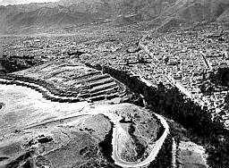
"Peruvian archaeologists have reported intriguing finds in the
Amazonian provinces of Peru, including the apparent remains of
stone-built cities, especially in the valleys of the Utcubamba and
Marañon rivers. There are undoubtedly "lost cities" in the tropical
zones, but in some instances the announced discoveries are really
expeditions to known sites.... There have been reports of aerial
sightings of "pyramids" on the Brazilian side of the border, of lost
cities such as Akakor, and Indian tales of ruins holding untold
treasures.... In the national archives in Rio de Janeiro there is
purportedly an eighteenth-century report recording a lost city seen
by Europeans in 1591.... It was the main reason for an expedition by
Colonel Percy Fawcett whose mysterious disappearance in the jungles
is still a subject of popular-science articles.
"....Humboldt’s reports of his travels
across the continent mention
a tradition that people from across the sea landed in Venezuela and
proceeded inland; and the principal river of the Cuzco valley, the
Urubamba, is but a tributary of the Amazon.... At one site near the
mouth of the Amazon, pottery urns decorated with incised patterns
that remind one of the designs of the earthenware jars from Ur (the
Sumerian birthplace of Abraham) have been found....
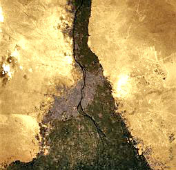
|
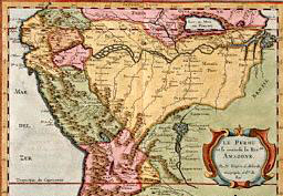
17th Century
Map of the Amazon Basin |
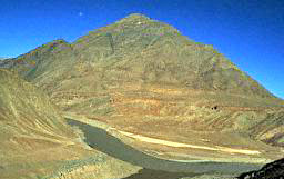
|
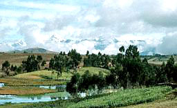
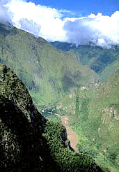
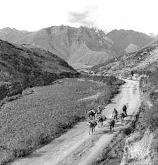
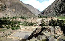
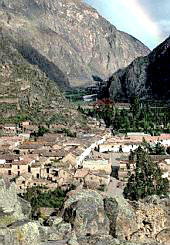
Urubamba
Valley, top. Urubamba River near Machu Picchu, right.
Urubamba River is a triburary of the Amazon.
|
 |
|
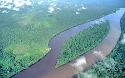
The Amazon
near La Esmeralda, Venezuela. |

Amazon River
entering the Atlantic Ocean, eastern coast of Brazil.
Taken from Shuttle Discovery. |
"....According to
L. Netto, Investigacioes sobre a Archaeologia Braziliera, similarly
decorated urns and vases "of superior quality" have been found
farther up the Amazon. And, we believe, an equally important route
connecting the Andes with the Atlantic Ocean did exist farther to
the south.
"Still, it is uncertain that the Incas themselves came this way. One
of their ancestry versions attributes their beginnings to a landing
on the Peruvian coast. Their language, Quechua, bears Far Eastern
resemblances both in word meanings and dialect. And they clearly
belong to the Amerindian stock - the fourth branch of mankind that,
we have ventured to suggest, stemmed from the line of Cain. (A guide
in Cuzco, hearing of our biblical expertise, asked whether In-ca
might have stemmed from Ca-in by reversing the syllables. One
wonders!)
"The evidence at hand, we believe, indicates that
the Near Eastern
tales and beliefs, including knowledge of the story of Nibiru and
the Anunnaki who had come from there to Earth - the pantheon of
twelve - were brought to the predecessors of the Incas from
overseas. It took place in the days of the Ancient Empire; and the
bearers of these tales and beliefs were also Strangers From Across
the Seas, but not necessarily the same ones who brought similar
tales, beliefs, and civilization to Mesoamerica.
"....Let us return to
Izapa, a site near the Pacific coast where
Mexico and Guatemala meet and where the
Olmecs and the Maya rubbed
shoulders.... It had the customary pyramids and ball courts; but it
has mostly amazed archaeologists by its carved stone monuments....
It was art belonging to the Early and Middle Preclassic Olmec,
adopted by the Maya as the site changed hands....
 Religious, cosmological, and mythological themes intermingled with
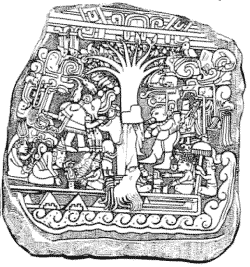
historical subjects are expressed in the stone carvings.... Of
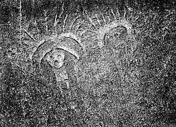
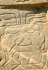
particular interest here is a large carved stone whose face measures
some thirty square feet, designated by the archaeologists Izapa
Stela 5
(click image right), found in conjunction with a major stone altar. The
complicated scene has been recognized by various scholars as a
"fantastic visual myth" concerning the "genesis of humanity" at a
Tree of Life that grows by a river. The mythical-historical tale is
told by an old bearded man seated on the left, and is retold by a
Maya-looking man on the right (of the stela’s observer).... Religious, cosmological, and mythological themes intermingled with
historical subjects are expressed in the stone carvings.... Of
particular interest here is a large carved stone whose face measures
some thirty square feet, designated by the archaeologists Izapa
Stela 5
(click image right), found in conjunction with a major stone altar. The
complicated scene has been recognized by various scholars as a
"fantastic visual myth" concerning the "genesis of humanity" at a
Tree of Life that grows by a river. The mythical-historical tale is
told by an old bearded man seated on the left, and is retold by a
Maya-looking man on the right (of the stela’s observer)....
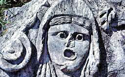
"....The left hand panel, when enlarged, clearly reveals details
which we consider extremely important clues. The bearded man tells
his story over an altar that bears the symbol of the umbilical
cutter; this was the symbol by which Ninti.... was identified on
cylinder seals and on monuments. When the Earth was divided among
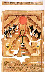
the gods she was given dominion over the Sinai peninsula.... they
called her Hathor and depicted her with cow’s horns,
as on this
Creation of Man scene. These "coincidences" reinforce the
conclusion that the Izapa Stela illustrates none other than
the Old
World tales of the Creation of Man and the Garden of Eden.
"And finally there are portrayals of
pyramids, smoothed sided as at Giza on the Nile, depicted here at the bottom of the panel beside a flowing
river. Indeed, as one examines and reexamines this millennia-old
panel, one must agree that a picture is a worth a thousand words.
"Legends and
archaeological evidence indicate that the Olmecs and the
Bearded
Ones did not stop at the edge of the ocean (Mexico), but pushed on
southward into Central America and the northern lands of South
America.
"....The legends in the equatorial and northern parts of
the Andes
recalled not only the arrival by sea of their own ancestors (such as
Naymlap), but also two separate ones by "giants." One had occurred
in ancient empire times, the other in Mochica times.
Cieza de Leon
described the latter thus:
"There arrived on the coast, in boats
made of reeds as big as large ships, a party of men of such size
that, from the knee downward their height was as great as the entire
height of an ordinary man...."
They dug wells in the living rock,
but for food they raided the natives’ provisions. They also violated
the natives’ women, for there were no women among the landing
giants. The Mochica depicted these giants who had enslaved them on
their pottery, painting their faces in black, while that of the
Mochica was painted white. Also found in
Mochica remains are clay
portrayals of older men with white beards.
"It is our guess that these unwanted visitors were
Olmecs and their
bearded Near Eastern companions who were fleeing the uprisings in
Mesoamerica, circa 400 B.C.... Archaeological expeditions to the
equatorial areas of the Pacific coast have found enigmatic monoliths
that stem from that fearsome period. The George C. Heye expedition,
found in Ecuador giant stone heads with humanlike features but with
fangs as though they were ferocious jaguars. Another expedition
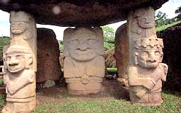
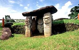
found at San Agustin, a site closer to the Colombian border, stone
statues portraying giants, sometimes shown holding tools or weapons,
their facial features are those of the African Olmecs.
San Agustin findings,
Colombia, South America
"These invaders may have
been the source of the legends current also in these lands of how
Man was created, of a Deluge, and of a serpent god who demanded an
annual tribute of gold.
"....The equatorial natives worshipped a pantheon of
twelve, a
number of great significance and an important clue. It was headed by
a triad consisting of the Creation god, the Evil god, and the
Mother
Goddess; and it included the god of the Moon, God ranked higher than
the Sun God.... The head of the pantheon was called in the Chibcha
dialect Abira - remarkably similar to the Mesopotamian divine
epithet Abir, which meant Strong, Mighty; and the
Moon God, as we
have noted, was called "Si" or "Sian," which parallels the
Mesopotamian name Sin for that deity.
"The pantheon of these
South American natives therefore brings
inevitably to mind the pantheon of the ancient Near East and the
Eastern Mediterranean - of the Greeks and the
Egyptians, the
Hittites and the Canaanites and Phoenicians, the
Assyrians and the
Babylonians - all the way back to where it all began: to the
Sumerians of Southern Mesopotamia from whom all others had obtained
the gods and their mythologies.
ASCENDING BACK
|

Rock
inscribed Ancient Near Eastern Urartian Cuneiform
Script. |
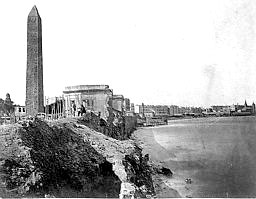
Obelisk over
the Mediterranean, Alexandria, Egypt. |
|
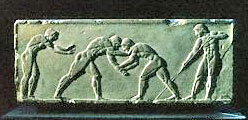
Ancient
Greek Ball Game |
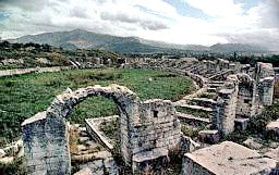
Greek Ruins
at Salona |
|
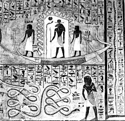
Mural "Solar
Boat" in Burial tomb of Egyptian Queen. |
|
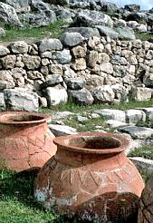
Hittite Pots |
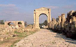
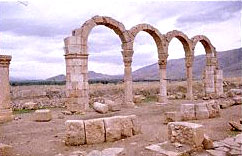
Phoenician
Ruin, Road and Arch in Tyre. |
|
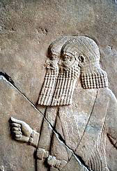
Assyrian Men
|
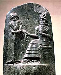
Baylonian
King Hammurabi, receiving the Law from Shamash.
|
|
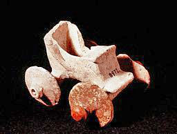
"Chariot"
dated at 1900 B.C. From Mesopotamia. |
"The Sumerian pantheon
was headed by an "Olympian Circle" of twelve, for each of these
supreme gods had to have a celestial counterpart, one of the twelve
members of the Solar System. Indeed, the names of the gods and the
planets were one and the same (except when a variety of epithets
were used to describe the planet or the god’s attributes).
At this point Mr. Sitchin briefly lists the head of the pantheon:
Anu, his spouse Antu and the two principal sons of Anu:
E.A/Enki
Firstborn but not from Antu; and EN.LIL/Enlil a son through Antu,
Anu’s half sister, therefore the Heir. Enki led the first mission to
Earth:
"....His mission was to
obtain gold, for which Earth was a unique
source. Not for ornamentation or because of vanity, but as a way to
save the atmosphere of Nibiru by suspending gold dust in that
planet’s stratosphere.
Eventually Enlil also came down from
Nibiru. Much later the division
of the land was decided and to Enki and his sons was given:
"....The lands of Ham - the
brown/black people - of Africa: the
civilization of the Nile Valley and gold mines of
southern and
western Africa - a vital and cherished prize.
|
View of Nile
Delta and the Great Pyramids (center left of Photo).
|
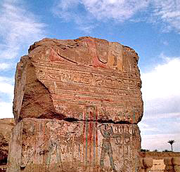
Relief of
the Nile God with Trays of Offerings at Abydos.
|
"The inhabited
Earth was
divided between the warring clans. The three sons of Enlil -
Ninurta,
Sin, Adad, together with Sin’s twin children,
Shamash (the Sun) and Ishtar (Venus), were given the
lands of Shem and Japhet, the land of
the Semites and Indo-Europeans:
-
Sin (the Moon) lowland
Mesopotamia
-
Ninurta ("Enlil’s Warrior," Mars) the
highlands of Elam and Assyria
-
Adad ("The Thunderer" Mercury)
Asia Minor, (the land of the
Hittites) and Lebanon
-
Ishtar was granted dominion as the goddess of
the Indus Valley civilization
-
Shamash was given command of the
spaceport in the Sinai Peninsula
The Inhabited Earth
was divided among the warring Clans....
To the sons of Enlil:
To Ninurta, Elam and
Assyria were given.
|
an ancient
ziggurat of the Elamites.
|
ancient
Assyrian soldiers |
|
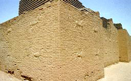
To Sin,
lowland Mesopotamia. (ancient wall in Babylon) |
To Adad,
Asia
Minor (the land of the Hittites) and Lebanon
|
a relief
carving Face of Myra, Turkey today. |
Ruins in
Lebanon. |
To Enlil’s
grandchildren was given:
To Shamash, the
Sinai Peninsula was given to him, to be in charge of the Spaceport.
|
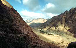
the much
talked about Monastery of Saint Katherina |
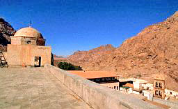
|
|
cliffs on
Sinai |
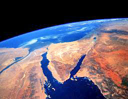
Sinai
Peninsula viewed from space. (Colombia Shuttle).
|
And to Ishtar
was given,
the Indus Valley Civilization
|

Seal from
Indus Valley |
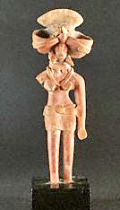
Mother
Goddess from Indus Valley Civilization. |
|
Ancient
Ruins in Harappa, today’s Pakistan |
the mergin
of Indus and Zanskar Rivers. Indus Valley.
|
This division.... gave
Enki and his sons the lands of Ham - the brown/black people - of
Africa.
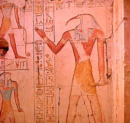
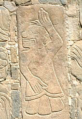
"A great scientist and metallurgist,
Enki’s Egyptian name was Ptah,
("The Developer"; a title that translated into Hephaestus by the
Greeks and Vulcan by the Romans). He shared the continent (African)
with his sons; among them was the firstborn MAR.DUK ("Son of the
Bright Mound") whom the Egyptians called Ra, and NIN.GISH.ZI.DA
("Lord of the Tree of Life") whom the Egyptians called Thoth (Hermes
to the Greeks) - a god of secret knowledge including astronomy,
mathematics, and the building of pyramids.
|
The Egyptian
name for Enki was "Ptah," depicted here with Sesostris
. |
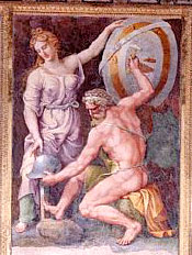
The Roman
name for Enki was "Vulcan," (the expert in dealing with
metals, who became the patron of metal dealers).
|
Enki shared the
African Continent with his sons:
|
There was
Marduk, the firstborn, whom the Egyptians called "Ra."
Above: Adoration of
Ra. |
And there
was NIN.GISH.ZI.DA, whom the Egyptians called "Thoth";
"Hermes" to the Greeks. Above: The God of Wisdom, Thoth,
surrounded by hieroglyphs. Abydos, the center for the
worship of Osiris, Egypt. |
|

The name of
Thoth for the Greeks was "Hermes"; above: Stoa of Hermes
and Heracles. Cyrene, Libya. Right: Sculpture of Hermes’
bust. (Roman made) |
 |
"It was the knowledge
imparted by this pantheon, the needs of the gods who had come to
Earth, and the leadership of Thoth, that directed the African Olmecs
and the bearded Near Easterners to the other side of the world....
to the lands of Central America and beyond.
"For that is where the gold was, in Spanish times and before.
"Before the Incas and the
Chimu and the Mochica, a culture named by
scholars Chavin flourished in the mountains that lie in northern
Peru between the coast and the Amazon basin.... It takes us back to
at least 1500 B.C.; and like the Olmec in Mexico at the same time,
it arose suddenly, with no apparent prior development.
"....The
Chavin culture appeared to have been centered at a site
called Chavin de Huantar near the village of Chavin. It is situated
at an elevation of 10,000 feet in the Cordillera Blanca.... An area
of some 30,000 feet was flattened and terraced and made suitable for
the construction of complex structures.... Not only do the buildings
and plazas form precise rectangular and squares, they have also
been precisely aligned with the cardinal points, with east-west as
the major axis.
"....The largest building was at the southwest corner, measured
about 240 by 250 feet.... The exterior’s precision was exceeded by
the interior complexity. Within the three structures there ran
corridors and mazelike passages, intermingled with connecting
galleries, rooms and staircases, or leading to dead ends and
therefore nicknamed labyrinths.... there are niches and protrusions
for no apparent purpose; and vertical or sloppy shafts that the
archaeologist thought might have served for ventilation.
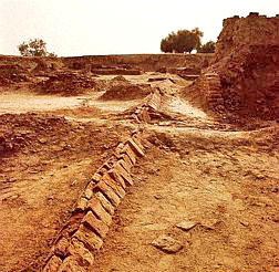
"What was Chavin the Huantar built for? The only plausible purpose
that its discoverers could see was that of a religious center, a
kind of ancient "Mecca."
"....Three fascinating and most enigmatic relics found at the site:
* in the main building the
Tello Obelisk, named so for his
discoverer, rich in design, conveys all the tales and myths, plus
geometrical figures.
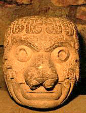
* at a nearby estate a carved stone called the
Raimondi Monolith was
found.... it depicts an anthropomorphic figure.... holding a weapon
in each hand, like a thunderbolt.... his face gives the impression
(to Mr. Sitchin and his party) of a face of a bull, "completely
absent in South America, but one that featured considerably in the
lore and iconography of the ancient Near East. Significantly (in the
opinion of Mr. Sitchin’s party) it was the "cult animal" of
Adad,
and the mountain range in his domain, in Asia Minor, is still called
to this very day the "Taurus Mountains."
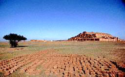
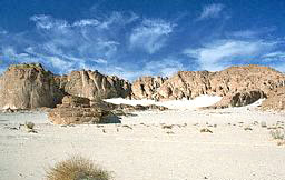
|
Findings of
the Chavin Culture |
|
 |
 |
|
Later days
road on the Peruvian side of the Andes |
The Taurus
Mountains in Asia Minor, (Turkey), the land of Adad,
where the "bull" was the cult animal, unknown in ancient
South America. |
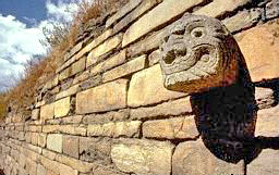
"A third unusual and
enigmatic carved stone column at Chavin the Huantar is called
El Lanzon because of its lancelike shape. It is twelve feet high ( also
apparently depicting the anthropomorphized face of a bull, and it
has remained in the middle building where it was discovered).
"....It was by and large the high artistic level of the artifacts
rather than the complex and unusual structures that so impressed
scholars and led them to consider Chavin as the "matrix culture" of
north-central Peru, and to believe that the site was a religious
center. But that the purpose was not religious and rather
utilitarian seems to be indicated by recent finds at Chavin de
Huantar. This latest excavations revealed a network of subterranean
tunnels hewed out of the native rock; they honey-combed the whole
site, both under built as well unbuilt parts, and served to connect
several series of underground compartments arranged in a chainlike
manner.
"The openings of the tunnels.... seemed to connect the two river
tributaries that flank the site, one (due to the mountainous
terrain) above it and the other in the valley below it.... Why did
the ingenious builders place their structures at such a vulnerable
spot?
"They did so, we hold, on purpose. They ingeniously used the two
levels of the tributaries to create a powerful, controlled flow of
water needed for the processes that were carried out at
Chavin de
Huantar. For there, as at many other sites, such devices of
flowing
water were used in the panning of gold.
"....Who was there at
Chavin de Huantar...? Reminiscent of the Olmec
art of Mexico. The enchanting objects include a jaguar-cat
receptacle, a feline bull, an eagle-condor, a turtle basin, a large
number of vases and other objects decorated with glyphs created of
entwined fangs - a motive decorating wall slabs as well as
artifacts. There were, however, also stone slabs covered with
Egyptian motifes - serpents, pyramids, the sacred eye of Ra. And as
though this variety was insufficient, there were fragments of carved
stone blocks that depicted Mesopotamian motifs, such as deities
within Winged Disks or (engraved on bones) images of
gods wearing
conical headdresses, the headgear by which Mesopotamian gods were
identified.
"The deities wearing the conical headdresses have facial features
that have an "African" look.... Could it be that
Africans-negroid,
Egyptian-Nubian - were ever at this South American site at its
earliest time? The surprising answer is yes. There are indeed
black
Africans here and at nearby sites (especially at one called
Sechin),
and they left their portraits behind.
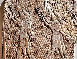
|
Pre-Incan
stone carving at Sechin: |
Two
warriors. |
"....The age of
Chavin
suggests that the first wave of these Old World, both Olmec and
Semitic migrants had arrived there circa
1500 B.C. Indeed, it was
the reign of the 12th monarch of the Ancient Empire that, as
Montesinos chronicled, "news reached Cuzco of the disembarking on
the coast of some men of great stature.... giants who were settling
on the whole coast" and who possessed metal implements.... but the
giants provoked the Great God and he destroyed them. These events
had taken place before the standstill of the Sun that had occurred
circa 1400 B.C. - i.e, circa 1500 B.C., the very time at which
Chavin de Huantar’s waterworks were built.
|
Artefacts in
Moche Warrior Tomb. |
"This, it must be
pointed out, is not the same incident reported by Garcilaso, about
giants who despoiled the land and raped women - an occurrence in
Moche times, circa 400 B.C.
"....Thus it was, after some 1,000 years in the northern Andes and
almost 2,000 years in Mesoamerica, that the African-Semitic presence
had come to a tragic end.
"Although some of the
Africans may have gone further south, as finds at Tiahuanaco attest,
the African-Semitic extension into the Andes from
Mesoamerica
appears to have not gone beyond the Chavin-culture area. The tales
of the giants stricken by divine hand may hold more than a kernel of
fact; for it is quite possible that there, in the Northern Andes,
two realms of two gods had met, with an unseen boundary between
jurisdictions and human subordinates.
"We say this because, in that very zone, other white men had been
present. They were portrayed in stone busts, nobly clad, wearing
turbans or headbands with symbols of authority, and decorated with
what scholars call "mythological animals." These bust-statues have
been mostly found at a site near Chavin named Aija.
 "....Is it possible that people from those distant lands (Asia
Minor, Elam and later from the Indus Valley) had crossed the
Pacific
and come to the Andes in prehistoric times?.... An ancient Near
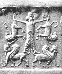
Eastern hero whose tales were told and retold, Gilgamesh, ruler of Uruk (the biblical
Erech) who had reigned circa 2900 B.C.; he went
in search of the hero of the Deluge story whom the gods had granted
(according to the Mesopotamian version) immortality.... One of his
heroic deeds, the wrestling with and defeat of two lions with his
bare hands, was a favorite pictorial depiction by ancient artists,
as this one on a Hittite monument.
(image left) "....Is it possible that people from those distant lands (Asia
Minor, Elam and later from the Indus Valley) had crossed the
Pacific
and come to the Andes in prehistoric times?.... An ancient Near
Eastern hero whose tales were told and retold, Gilgamesh, ruler of Uruk (the biblical
Erech) who had reigned circa 2900 B.C.; he went
in search of the hero of the Deluge story whom the gods had granted
(according to the Mesopotamian version) immortality.... One of his
heroic deeds, the wrestling with and defeat of two lions with his
bare hands, was a favorite pictorial depiction by ancient artists,
as this one on a Hittite monument.
(image left)
"Amazingly, the same depiction appears on stone tablets from
Aija
and a nearby site, callejon the Huaylas in the Northern Andes. If
legends be the guide, they preceded the two waves of African
"giants" and Mediterranean Bearded Ones, and could have been the
earliest settlers of which the tale of
Naymlap recounts. The
traditional landing site for that arrival has been the Peninsula of
Santa Elena (now Ecuador), with its nearby La Plata island, just out
in the Pacific. Archaeological excavations have confirmed early
settlements there, beginning with what is called Valdivian Phase
circa 2500 B.C. Among the finds reported.... were stone statuettes,
with the same straight-nose features as well as a symbol on pottery
that was the Hittite hieroglyph for "gods."
"....The handiwork of the megalithic builders -
Indo-European guided
by their gods? - which began south of Chavin has left its mark all
the way south into the valley of the Urubamba river and beyond.
"....West-southwest of Cuzco, on the way to the town of
Abancay, lie
the ruins of Sayhuiti-Rumihuasi. As the other sites it is also
situated near the junction of a river and a smaller stream.... The
Great Monolith was found there.... at a distance it appears as an
immense bright egg.... its bottom part has been carefully shaped as
an ovoid.... the upper part represents in all probability a scale
model of some unknown area.... (plus other features, shaped with
geometric precision which Mr. Sitchin likens to dies or matrixes
for the casting of some ultramodern instruments.)
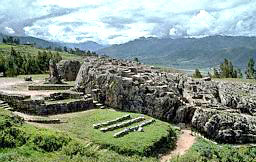
"One of the better
known sites, just east of Sacsahuaman, is called
Kenko - a name which in the native tongue means "Twisting Channels."
KENKO Shrine
near Cuzco
"The main tourist
attraction there is a huge monolith standing on a podium that it may
have represented a lion or other large animal standing on its hind
legs. In front of the monolith is a six-foot high wall built of
beautiful ashlars, surrounding the monolith in a circle. The
monolith stands in front of an immense natural rock and the circular
wall reaches and ends at the rock as a pincer. In the back the rock
has been cut, carved, an shaped into several levels connected by
staggered platforms. Zigzagging channels have been cut in the rock’s
artificially sloping sides and the rock’s interior has been hewed
out to create labyrinthine tunnels and chambers. Nearby a cleft in
the rock leads to a cavelike opening that has been hollowed out with
geometric precision to form stone features that some describe as
thrones and altars.
Mr. Sitchin mentions a few more sites where more carvings of precise
features have been found on stone, water appearing to be of most
importance to have a relation with these stone features.
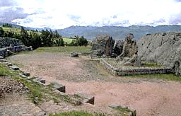
"....But what was
Sacsahuaman itself, now that the notion of its
having been built by the Incas as a fortress is completely
discredited? One is the fact that walls, conduits, receptacles,
channels, and the like have been created both out of the living rock
and with the aid of perfectly shaped large ashlars, many of the
polygonal kind of the Megalithic Age, to form a series of
water-channeling structures one above the other; rain or spring
water could thus be made to flow in a regulated manner from level to
level.
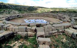
"The other aspect is the uncovering of a huge circular area
enclosed
by megalithic ashlars, that by all opinions served as a reservoir.
Also uncovered was a sluice-chamber built of megalithic ashlars,
that lies underground at a level permitting the running off of the
water from the circular reservoir.... the channel leading away from
this sluice-chamber leads to the Chingana or "Labyrinth" carved out
of the native rock behind and below this circular area.... It all
looks like a large-scale gold-panning facility. The water was
finally flowed off through the sluice-chamber, and out and away
through the labyrinth. In the stone vats, what remained was gold.
"What then did the megalithic, colossal
zigzagging walls, at the edge
of the promontory, protect or support? To this question there is
still no clear answer, except to surmise that some kind of massive
platform was required for the vehicles - airborne, we must presume -
that were used to haul the ores and take away the nuggets.
|
The Circular
Area, enclosed by megalithic ashlars. |
The
Zigzagging Walls |
"One site that may have
served, or was intended to serve, a similar transportation function,
located some sixty miles northwest of Sacsahuaman, is
Ollantaytambu.
The archaeological remains atop a steep mountain spur, they overlook
an opening between the mountains that rise where the
Urubamba-Vilcanota and Patcanchar rivers meet. A village that gave
its name to the ruins is situated at the bottom of the mountain; the
name, meaning: "Restplace of Ollantay," stems from the time an Inca
hero prepared there a stand against the Spaniards.
"....The greatest mystery of
Ollantaytambu is there: a row of six
colossal monoliths that stand on the topmost terrace.... their
thickness varies from three to over six feet.... At least two of the
monoliths bear the weathered remains of relief decorations; on the
fourth one (counting from the left) the design is clearly that of
the Stairway symbol; all archaeologists agree that the symbol, which
had its origin at Tiahuanacu at Lake Titicaca, signified the
ascent
from Earth to Heaven or, in reverse, a descent from Heaven to
Earth.... One provides a most significant clue: a deep T shape has
been cut into it. All the scholars having found such cuts in
gigantic stone blocks at Tiahuanacu, had to agree that this
groove
was intended to hold together two stone blocks with a metal clamp;
as a precaution against earthquakes.
"One must therefore wonder how scholars can
continue to attribute
these remains to the Incas, who did not possess any metal
except
gold, which is too soft and thus totally unsuitable to hold together
colossal stone blocks shaken by an earthquake. Naive too is the
explanation that Inca rulers built this colossal place as a gigantic
bathhouse, for bathing was one of their cherished pleasures. With
two rivers running just at the foothills, why haul immense blocks -
some weighing as much as 250 tons - to build a bath up the hill? And
all that without iron tools?
"More serious.... the size and the massivity of the stone blocks
bring to mind the colossal stone blocks used to construct the unique
platform at Baalbek, in the Lebanon mountains. In
The Stairway to
Heaven we described and examined at length that megalithic platform,
and concluded that it was the "landing place" that had been the
first destination of Gilgamesh - a landing place for the "aerial
ships" of the Anunnaki.
|
Ollantaytambu, Ruins and recent villages.
|
 |
"Whose handiwork was
Ollantaytambu? Garcilaso de la Vega wrote that it was "from the very
first epoch, before the Incas." Blas Valera stated, "from an
era
that anteceded the epoch of the Incas... the era of the pantheon of
the gods of pre-Inca times." It is time that modern scholars agree.
"It is also time to realize that these gods were the same deities to
whom the construction of
Baalbeck has been attributed by Near
Eastern legends.
"Was Ollantaytambu intended to be a stronghold, as
Sacsahuaman might
have been, or a landing place, as Baalbeck had been?
"In our previous books we have shown that, in determining the site
of their spaceport and "landing places," the Anunnaki first anchored
a landing corridor in some outstanding geographical feature (such as
Mount Ararat). The flight path within this corridor was then
inclined at a precise 45 degrees to the equator. In postdiluvial
times, when the spaceport was in the Sinai peninsula and the landing
place for airborne craft in Baalbek, the grid followed the same
pattern.
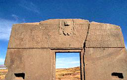
"The Torreon at Machu Picchu has, besides the two observation
windows in the semicircular section, another enigmatic window that
has an inverted stairway opening at its bottom and a wedgelike slit
at its top. Our own studies show that a line from the Sacred Rock to
the slit to the Intihuatana will run at precise angle of 45 degrees
to the cardinal points, thus establishing for Machu Picchu its
principal orientation.
"This 45 degree orientation determined not only the layout of
Machu
Picchu, but also the location of major ancient sites. If one draws
on a map of the region a line connecting the legendary stops made by
Viracocha from the Island of the Sun in Lake Titicaca, the line will
pass Cuzco and continue to Ollantaytambu -
precisely at a 45 degree
angle to the equator!
"A series of studies and lectures by
Maria Schulten de D’Ebneth,
summed in her book La Ruta de Wiracocha, showed that the 45 degree
line on which Machu Picchu is located fits a grid pattern along the
sides of a square tilted at 45 degrees (so that the corners, not the
sides, point toward the cardinal points). She confessed that she was
inspired to search for this ancient grid by the Relacion of
Salcamayhua. Relating the tale of the three windows, he drew a
sketch to illustrate the narrative, and gave each window a name:
Tampu-Tocco, Maras-Tocco, and Sutic-Tocco. Maria Schulten realized
that these are places names. When she applied the tilted square to a
map of the Cuzco-Urubamba area, with its northwestern corner at
Machu Picchu (alias Tampu-Tocco), she discovered that all the other
places fell into the correct positions. She drew lines showing that
a 45 degree line originating at Tiahuanacu, combines with squares
and circles of define measurements, embraced all the key ancient
sites between Tiahuanacu, Cuzco and
Quito in Ecuador, including the
all important Ollantaytambu.
|
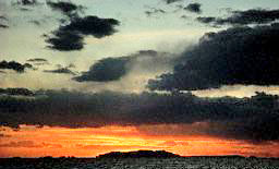
SUNSET ON LAKE
TITICACA |
"No less important is
another finding by her. The subangles that she had calculated
between the central 45 degree line and sites located away from it,
such as Pachacamac’s temple, indicated to her that the
Earth’s tilt
("obliquity") at the time this grid was laid out was close to 24º
08’, this means the grid was planned (according to her) 5,125 years
before her measurements were done in 1953, in other words, in 3172
B.C.
"It is a determination that confirms our own conclusion that the
megalithic structures belong to the Age of Taurus the era between
4000 B.C. and 2000 B.C. And, by combining modern studies with the
data provided by the chroniclers, it affirms what the legends kept
reiterating:
"It all began in
Lake Titicaca.
Return
Chapter Ten
"BAALBEK OF THE
NEW WORLD"
"Every version of every legend in
the Andes points to Lake Titicaca
for the Beginning - the place,
-
where the great god
Viracocha
performed his creative feats
-
where mankind reappeared after the
Deluge
-
where the ancestors of the Incas were granted a golden wand
with which to establish Andean civilization
If this be fiction,
then it is supported by fact; for it is in the shore of Lake
Titicaca that the first and greatest city in all of the Americas
has stood.
"Its scope, the size of its monoliths, the intricate carvings upon
its monuments and its statues have amazed all who have seen
Tiahuanacu (as the place has been called) ever since the first
chronicler described it for Europeans.... The greatest puzzle of all
is the location itself: a barren, almost lifeless place some 13,000
feet - four kilometers - up among the highest Andean peaks that are
permanently snow-covered. Why would anyone expend incredible effort
to erect colossal edifices out of stone that had to be quarried and
brought over for many miles away in this treeless, windswept
desolate place?
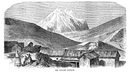
"The thought struck Ephraim George Squier when he reached the lake a
century ago.... "The waters hide a variety of strange fishes, which
contribute to support a population necessarily scanty.... The only
grain is quinoa.... where the only indigenous animals fit for food
are the biscacha, the llama, and the vicuna." Yet in this treeless
world, he added, "if tradition be our guide, were developed the
germs of Inca civilization" from an earlier, "original civilization
which carved its memorials in massive stones, and left them in the
plains of Tiahuanaco, and of which no tradition remains except that
they are the work of the giants of old, who reared them in a single
night."
|
 |
Fishing in
Lake Titicaca today |
|
Carrying
reeds. |
Vicuna,
(endangered species) |
"A different thought,
however, struck him as he climbed up a promontory overlooking the
lake and the ancient site.... From a ridge at the southwestern edge
of the plain in which the lake is situated, near where the waters
flow out southward through the Desaguadero river, he could see not
only the lake with its southern peninsulas and islands, but also the
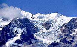
snowy peaks to the east.... Dominating the lake is the massive bulk
of Illampu, or Sorata, the crown of the continent, the highest
mountain of America, rivaling, if not equally in height, the
monarchs of the Himalayas; observers vary in their estimates and
calculations of its altitude from 25,000 to 27,000 feet." Southward
from this outstanding landmark the uninterrupted chain of mountains
and peaks "terminates in the great mountain of Illimani, 24,500 feet
in altitude.... Nowhere else in the world, perhaps," Squier went on,
"can a panorama so diversified and grand be obtained from a single
point of view. The whole great tableland of Peru and Bolivia, at its
widest part, with its own system of waters, its own rivers and
lakes, its own plains and mountains, all framed in by the ranges of
the Cordilleras and the Andes, is presented like a map."
|
Snow on
Mount Illampu, Bolivia |
A Painting
of Mount Illimani, Bolivia |
|
 |
"Monarchs"
of the Himalayas |
"Were these geographical
and topographical features the very reason for the selection of the
site - at the edge of a great plain basin, with two picks that stand
out not only from the ground but also from the skies - just as the
twin peaks of Ararat (17,000 and 13,000 feet) and the two pyramids
of Giza had served to mark the landing paths of the Anunnaki?
"Unbeknown to Squier, he had raised the analogy, for he had titled
the chapter describing the ancient ruins "Tiahuanaco, the
Baalbec of
the New World"; for that was the only comparison he could think of -
a comparison with a place that we have identified as the landing
place of the Anunnaki to which Gilgamesh had set his steps five
thousand years ago.
"The greatest explorer of Tiahuanaco and its ruins this century has
been, without doubt, Arthur Posnansky, a European engineer who moved
to Bolivia and devoted his lifetime to unraveling the mysteries of
these ruins. As early as 1910 he complained that, from visit to
visit, he saw less and less of the artifacts, for the local natives,
builders in the capital La Paz, and even the government itself for
construction of the railroad, systematically carry off the stone
blocks not for their artistic or archaeological value, but as freely
available building materials.... Yet the little that remained -
mainly because it was too massive to move - impressed him that this
were remains of a civilization that disappeared before that of the
Incas began, a civilization contemporary with that of Egypt and the
Near East.
"Pedro Cieza de Leon, who travelled throughout what is now
Peru
and Bolivia in the years 1532-1550 reported in his Chronicles that,
without doubt, the ruins of Tiahuanaco were "the most ancient place
of any that I have yet described."
Another site near Tiahuanako with notable remains is
Puma-Punku, so
named by the Indians....
"....Here the clamps (to hold the stone blocks together against
earthquakes) were made of bronze. That this was so is known because
some of these bronze clamps have actually been found. This is
certainly a discovery of immense significance, for bronze is a most
difficult alloy to produce, requiring the combination of a certain
proportion of copper (about 85-90%) with tin; and whereas copper can
be found in its natural state, tin must be extracted by difficult
metallurgical processes from the ores in which it is contained.
"How was this bronze obtained, and was its availability not only
part of the puzzle but also a clue to the answers?
"Putting aside the
customary explanation that the colossal and intricate structures of
Puma-Punku were "a temple," what practical purpose did it serve?....
The German master architect Edmund Kiss.... believed that the mounds
and remains flanking and fronting on the four-part collapsed section
were elements of a harbour, for the lake had extended that far in
antiquity. But this leaves open and even reinforces the question,
what was going on at Puma-Punku? What did it import and what
products did it ship out at this barren altitude?
"Ongoing excavations at
Puma-Punku have uncovered a series of
semisubterranean enclosures constructed of perfectly shaped stone
blocks. They remind one of the sunken plazas of Chavin de Huantar,
and raise the possibility that these were elements - reservoirs,
pools, sluice-chambers - of a similar waterwork system.
"....There is absolutely no plausible explanation for these
artifacts except to suggest - based on our own present technology -
that these were matrixes, dies for the casting of
intricate metal
parts for some complex and sophisticated equipment that Man in the
Andes, or for that matter anywhere else, was absolutely incapable of
possessing in pre-Inca times.
"....Arthur Posnansky, who first presented his extraordinary work
and insights in the 1914 extensive volumes of Una Metropoli
Prehistorica en la America del Sur and, after another three decades
of devoted research, in the four-volumed Tihuanacu - Cuna del Hombre
de las Americas, combines with an English translation (in 1945).
This edition was honored with an official foreword by the Bolivian
government (the site ended up in the Bolivian part of the lake after
its partition from Peru), and celebrated "the 12,000th year of Tiahuanacu."
"....The most outstanding (and controversial) conclusion of
Posnansky: that Tiahuanacu was millennia old, that its first phase
was built when the level of the lake was about one hundred feet
higher and before the whole area had been engulfed by an avalanche
of water - perhaps the famous Great Flood, thousands of years before
the Christian era.... Posnansky, (after much study of the area)
concluded that there had been three phases in the history of
Tiahuanacu; that it was settled by two races - first the Mongoloid
people, then Middle Eastern Caucasians - and at no time by the
negroid people.... The main interest was and remains on three major
components of the site.
"The one at the southeastern part of the ruins is a hill known as
the Akapana. It was probably given originally the shape of a
stage-pyramid, and is presumed to have acted as the fortress
guarding the site.... Rumors however persisted that it was a place
where gold was hidden, and in the eighteenth century a Spaniard
named Oyaldeburo was given a mining concession for the Akapana. He
cut through the eastern side of the hill to drain off the water,
searched the bottom of the reservoir, tore down structures of
beautiful ashlars, and dug deep into the hill wherever he found
channels and conduits.
"....That some processing might have taken place in
the Akapana is
further suggested by the discovery on the surface and in the soil
removed from the "reservoir" of large quantities of dark-green
rounded "pebbles" that ranged in size from three fourths of an inch
to two inches. Posnansky determined that they are crystalline, but
neither he nor others (to our knowledge) conducted further tests to
determine the nature and origin of these globular objects.
A few more paragraphs, in the book, explain the vast systems of
conduits in Tiahuanacu, apparently leading to the
Akapana. Mr.
Sitchin continues:
"The indications were of extensive ground and underground waterworks
at Tiahuanacu; and Posnansky devoted to them a whole chapter in his
ultimate work, titled Hydraulic Works in Tihuanacu. Recent
excavation have uncovered more stone conduits and water channels,
confirming the conclusions of Posnansky.
"The second outstanding edifice at
Tiahuanacu needed the least
excavating.... Known as the Gate of the Sun, it has been described
by Posnansky as "the most perfect and important work.... a legacy
and elegant testimony of the cultured people and their leader’s
knowledge and civilization." All who have seen it agree, for it is
amazing not only by dint of having been cut and shaped out of a
single block of stone (measuring about ten by twenty feet and
weighing over one hundred tons), but also because of the intricate
breathtaking carvings upon it.
"There are niches and geometric carved openings and surfaces on the
lower part of the gate’s front and on its back side, but the
marveling has been at the carved section on the gate’s upper front
part. There a central figure, almost three dimensional though carved
only in relief, is flanked by three rows of winged attendants; a
lower row of images depicting only the central figure’s face framed
by a mendering line, completes the composition.
|
Front of
Gate of the Sun (Puerta del Sol) |
 |
"There is general
agreement that the central and dominant figure is that of Viracocha,
holding a scepter or weapon in the right hand and a forked lightning
in the other.
By studying all the carvings,
Posnansky discovered that the Gate was
a solar calendar, discovered the planets that bond Heaven and Earth;
the Stairway, the "trademark" of Tiahuanacu.
Mr. Sitchin continues:
"He acknowledged that it was a
glyph based on the Mesopotamian
ziggurats, but noted that he did not think therefore that there had
been Sumerians at Tiahuanacu.
All that reinforced his growing sense that the
Gate of the Sun was
part of a larger structural complex at Tiahuanacu whose purpose and
function was to serve as an observatory; and this guided him in his
most important and, as it turned out, most controversial work and
conclusions.
"Official records of the
Commission for the Destruction and
Expiation of Idolatry, established by the Spaniards for that clear
purpose (although some suspect it was also a cover for treasure
hunting), attest that the Commission’s men arrived in Tiahuanacu in
1625. A 1621 report by Father Joseph de Arriaga listed over 5,000
"objects of idolatry" that were obliterated by breaking, melting, or
burning. What they did at Tiahuanacu is not known. The
Gate of the
Sun, as early photographs show, was found in the nineteenth century
standing broken in two at the top, with the right-hand part leaning
dangerously against the other half.
Posnansky believed that
the Gate was not damaged by the Commission,
rather they might have not seen it at the time, as it was already
fallen and covered by soil. Then there were doubts that whoever
re-erected it did not place it on its original site. But this
argument had the size and weight of the Gate against it, so the
opinion was that the Gate remained on its original site. Mr. Sitchin
continues:
"....A huge structure just east of it, called
Kalasasaya, was
delineated by a series of vertical pillars, which is what the name
meant ("The Standing Pillars"), revealing a somewhat rectangular
enclosure measuring 450 by 400 feet. Since the axis of this
structure appeared to be east-west, some wonder whether the gate
should not have stood in the center rather than in the northern edge
of the enclosure’s western wall (as it now does).
"....Posnansky found along this axis various stones especially
carved to permit astronomical observations; and his conclusions that
the Kalasasaya was an ingenious celestial observatory is now
accepted as a matter of fact.
"The most obvious archaeological remains of the
Kakasasaya have been
the standing pillars.... Of particular interest to Posnansky were
eleven pillars erected alongside the terrace protruding from the
center of the western wall.... His measurements (in relation with
the structure).... convinced him that the Kalasasaya was built by
people with ultramodern knowledge of astronomy for the precise
fixing of the equinoxes as well of the solstices.
"The architectural drawings of
Edmund Kiss (Das Sonnentor von
Tihuanaku), based on Posnansky’s work as well as on his own
measurements and evaluations, envision (probably correctly) the
structure inside the enclosure as a hollow stage-pyramid: a
structure whose outer walls rise in stages but only to surround a
central open-air square courtyard. The principal monumental stairway
was in the center of the eastern wall; the principal observation
points were in the centers of the two wider terraces that completed
the "pyramid" on the west.
"It was on this point that
Posnansky made his most startling
discovery with the explosive ramifications. By measuring the
distances and angles between the two solstice points, he realized
that the obliquity of the Earth against the Sun on which the
astronomical aspects of the Kalasasaya were based did not conform to
the 23.5 degrees of our present era.
"The obliquity of the ecliptic, as the scientific term is, for the
orientation of the Kalasasaya’s astronomical lines of sight, he
found, was 23o 8’ 48". Based on the formulas determined by
astronomers at the International Conference of Ephemerides in Paris
in 1911, which takes into account the geographical position and
elevation of the site, this meant that the Kalasasaya was built
circa 15,000 B.C.!
"Announcing that Tiahuanacu was the
oldest city in the world, one
that was "built before the Flood," Posnansky inevitably aroused the
wrath of the scientific community of his time; for it was held then,
based on the theories of Max Uhle, that Tiahuanacu was established
some time at the beginning of the Christian era.
After investigations were carried out on site by various entities
from Germany and the Vatican it was agreed that:
"....The Kalasasaya was indeed an
astronomical-calendrical
observatory.... Posnansky was essentially correct about the
obliquity.... The astronomical team concluded that the results could
indeed indicate a date circa 15,000 B.C., but also one of 9,300 B.C.
depending on the curved used.
"Needless to say, even the latter date was simply unacceptable to
the scientific community.... Further studies were conducted in
Peru
and Bolivia, teaming up with Posnansky in
Tiahuanacu.... different
possible points were taken into consideration.... Rolf Muller
published a definite report in the leading scientific journal Baesseler Archiv (vol. 14) in which he stated all the alternatives
and concluded that if the angle of 24o 6’ is to be accepted as the
most accurate, the obliquity curve would cross this reading at
either 10,000 B.C. or 4000 B.C.
"Posnansky was invited to
address the Twenty-Third International
Congress of Americanists.... conceding that this was "thorny
material," he left the matter hanging by agreeing that it needs
further study.
"Such studies have indeed been conducted, even if not directly at
Tiahuanacu. We have already mentioned that the calendar of the Incas
indicated a Beginning in the Age of the Bull, not of Aries (the
Ram).... And we have also referred to the research, along totally
different lines of investigation, by Maria Schulten de D’Ebneth
which led her to conclude that the Grid of Viracocha conformed to an
obliquity of 24o 8’ and thus to the date 3172 B.C. (by her
calculations).
"....The official 1981 report by Carlos Ponce Sangines.... states
that samples of organic matter found at this location (excavations
on the east side of Kalasasaya) gave radiocarbon readings of 1580
B.C....This does not preclude an older age for the stone structures
making up the site. Indeed Ponce Sangines himself revealed in a
subsequent study.... that new dating techniques called Obsidian
Hydration gave the earlier date 2134 B.C. for obsidian objects found
at the Kalasasaya.
"But why was Tiahuanaco established, at this site, at that early
time?
"In view of our own conclusions that the original (and practical)
purpose of Teotihuacan (Mexico) and its edifices was expressed by
the site’s waterworks, within and alongside the two pyramids; the
water channels inside the Akapana (Bolivia) and throughout
Tiahuanacu assume a central role. Was Tiahuanacu established where
it was as a processing facility? And if so, of what?
"....The discovery of the "small green pebbles...." Significantly,
the boulders in the retaining walls in the piers of Puma-Punku (Kiss
had envisioned a quay at the edge of the Lake) have also turned
green. That can mean only one thing: exposure to copper, for it is
oxidized copper that gives stone and soil their greenish color (just
as the presence of oxidized iron rends a red-brown hue).
"What
Tiahuanacu was the source of should have been clear from the
very meaning of the name of its location: Titicaca.... It was there,
the legends tell, that the rays of the Sun had struck Titikalla, the
sacred rock.... It was there at the sacred rock, that Viracocha
granted the divine wand to Manco Capac.
"....Titi in the
Aymara language was the name of a metal - either
lead or tin, according to linguists.
"Titikalla, we suggest, meant the "Rock of Tin."
Titicaca meant
"Stone of Tin." And Lake Titicaca was the lake that was the source
of tin.
"Tin, and bronze, were the products for which
Tiahuanacu was
established - right where its ruins still enchant.
Return
|